|
 |
Nov 1993 |
|
At Last, A Plan of Management
George Cotis and Paul Martin |
 |
There is a shared desire to preserve Port Hacking as an essentially unspoiled, largely shallow recreational waterway. The physical beauty of the Port, the pleasure of enjoying the waterway, the recreational opportunities provided along the foreshore, the regular visits by dolphins and (occasionally) whales. These are all a joy and a privilege to enjoy.
This privilege is available to all the residents of the Shire, the boating community, those concerned for the environment, visitors to the area, and all other users of the Port and its foreshores. This shared interest in preserving the Port as a largely unspoiled maritime parkland holds the promise of high levels of consensus in the way in which the Port is managed. Historically, this potential synergy has not been realised, with conflicts between different classes of users over particular issues clouding the potential for amicable and positive approaches to meeting the interests of all users.
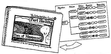
However, there are strengthening signs that at last this potential may be turning into reality. In November 1992, Sutherland Shire Council formally adopted a Plan of Management for Port Hacking. The 8 years-in-formation plan contains landmark precedents in the administration of a region. What's in the plan is revealed in this special introduction to the document starting on page three. The plan in its entirity,- (120 A3 pages), can be inspected at any branch of Sutherland library - (no time limit), or purchased from Sutherland Council's Environmental Services Enquiry Counter for $20.00. ($50 colour) |
 |
Why have a Plan?
To achieve administrative co-ordination.
A plan of management for Port Hacking is needed to provide a basis for co-ordination of the activities of the various authorities who each have partial responsibility for various aspects of the management of Port Hacking, the Hacking River, the foreshores, and activities carried out in relation to these.
A plan for Port hacking would also provide a starting point for the development of an integrated approach to managing Port Hacking and its catchment, to both preserve its unique character and its amenity for all the users.
A range of organisations have a partial jurisdiction over various activities within the Port. However, none have a full jurisdiction, and all are under-resourced. One result is uncoordinated and poorly enforced control over a host of activities and factors that have the potential to collectively diminish what we all value highly. Another result is unnecessary conflicts between groups of users who in reality have a common interest in the long term and sustainable use of the Port. A third consequence is uncertainty for all users about what will or will not be permitted, and what impact others will have on their intended use of the Port.
The result of this complex web of authorities, regulations and interested bodies is not, as one might expect, a tight supervision and control over potentially damaging activities within the Port. Where problems are identified, or breaches of the controlling laws apparent, rectification and enforcement are hindered by the absence of jurisdiction in any authority to deal with the whole of any problem. Coupled with this, the overlay of interest groups creates a situation where it is (at best) difficult for the regulating bodies to obtain a clear perspective on what the community wants and expects.
The most significant risks to Port Hacking and the preservation of what is valued by all are not singlefold major developments or disastrous events. The real concerns are incremental destruction arising from a series of short term decisions taken in isolation from other decisions. Such decisions have created demonstrable adverse impacts in the past, which we are now trying to contain or correct: Examples are:
-
incremental impacts on water quality from past practices such as allowing sewerage effluent and stormwater runoff to enter the Port at a number of points;
-
the combined impacts of individual decisions resulting in the loss of trees and other elements in the natural character of the Port;
-
a loss of shellfish and juvenile fish habitats, due to ill managed harvesting and irresponsible use.. All of these are undesirable consequences of the absence of an overall co-ordination and planning mechanism for the Port.
It is anticipated that in the next few years these challenges will present themselves:
-
in diminishing water quality as a result of runoff problems throughout the catchment;
-
as planning applications for foreshore constructions, on the southern side of the Port as well as on the northern shore;
-
in pressures for increased tourist facilities, including accommodation, waterway access and foreshore construction;
-
as demands for a major "solution" to the difficulties of large boat access throughout the Port;
-
in an increased conflict between use and development, and the natural and aesthetic values of the area.
The Plan of Management offers the potential to express and put into action the common vision for Port Hacking. It offers the chance to co-ordinate the activities of the host of bodies with partial jurisdiction, within a framework driven by the community's agenda for Port Hacking, rather than the individual agendas of the various departments involved. It also offers a forum for the development of a longer term planning framework against which individual activities, decisions and proposals can be evaluated, minimising the risks of uncoordinated and unplanned decisions accumulating in a manner which is damaging to the Port and those who have a concern for its health, beauty and recreational values.
A plan of management is an essential instrument to bring about a cooperative management approach, one that can draw together the physical, biological, and social components of the region toward a total framework for the future. The plan is also a medium by which to reflect the wider community's aspirations and set in place a set of values about Port Hacking. It forms a basis for addressing in a planned manner the expected challenges to the continuation of use of the Port in the way valued by all the community.
The history of the Plan's development
In 1984 Sutherland Council appointed a committee which had the charter to prepare a plan of management for Port Hacking, and to provide advice to Council on matters relating to Port Hacking.
The committee was made up of Councillors, various Council staff, and representatives of NSW Fisheries, the National Parks and Wildlife Service, and the NSW Public Works Dept. Importantly, four citizen members were appointed.
At the time, the pressing issue was perceived to be the shoaling of the port. This was for many reasons, not the least of which was the growing number of increasingly large private boats using Port Hacking.
Considerable resources had been committed to the study of Port Hacking's shoaling since the 1970's, particularly by the Dept of Public Works. Accordingly, when work began on a Plan of Management for the waterway, the shoaling issue already had considerable momentum, and the Plan soon became driven by it, particularly the case for a "solution" requiring engineering intervention. All of this developed despite the overall few people in Port Hacking directly and adversely affected by shoaling, (ie; the number of users of deeper keeled vessels in the Port was relatively small).
Though the Plan began its life with this single focus, the Advisory Committee was nevertheless able to take a step back and look at the wider picture early in the process. There were, indeed, more facets to the Port than big boating, and many issues of equal importance to shoaling, eg;- water quality, the visual setting, passive recreation, foreshore access to the waterway,- all of these began to emerge as just as significant issues to the wider Port Hacking community. The total picture began to emerge. It became clear that the catchment and the urban environment were inseparable from the waterway itself, and that actions in one area would have a consequence in another.
So, despite the powerful momentum of the shoaling issue, values about Port Hacking began to emerge, and the importance of starting planning with an understanding of community values began to crystallise. However, to take this new understanding of issues and values through to the specific aims and objectives needed to formulate a plan, issues that might have been perceived as "problems" requiring solutions had to be reconciled with community aspirations.
Community perceptions
Community attitudes were gathered by research, by input through the Advisory Committee, direct responses to Council, representation through community organisations, and by professional research (Elliott & Shanahan - "A Study of Resident Attitudes to Port Hacking", October 1987).
This report identified what residents want for the Port in terms of what they don't want, which was: Anything which is likely to dramatically change the character of the Port and its waterways: - eg,- extensive foreshore development. When quizzed about possible dredging or other works designed to improve access for deeper draught vessels the vast majority of people in this study were in favour of some form of "controlled dredging" to alleviate the sand shoaling problems in the major navigational channels and siltation from the heads of bays. It was felt that there was a need for balance between the desires of the users of the waterways - either active or passive - and maintenance or preservation of the unique charm of the port and the Hacking River.
In essence, the Advisory Committee concluded in line with the market research conclusions, ie; that the community places the highest priority on the unspoilt aesthetics of the Port, is concerned for the preservation of the ecological values of the Port, is oriented towards recreational uses of the Port which involve active inter-action with the waterway and foreshores, and is in favour of improving the navigational aspects of the Port, within the constraints of the preceding points.
Other Factors...the picture goes on widening
Other factors to do with Port Hacking's management that came into focus were the increasing recreational pressures on the region as Sydney expanded to the south west, particularly as it affected growing visitation levels in the Royal National Park, and the Park's own growing urban interface, permitting, (amongst other things), increased access from the waterways.
New trends in water based recreation were emerging and these were creating their own demands, pressures, and even areas of conflict. Power, paddle, sail, and swimmers are often a mix, sometimes a happy one, just as often not.
Urban practices came into sharper focus. In this period availability of foreshore land for housing became restricted to the steeper, previously inaccessible land leading down to the foreshore. Developments on these sites invariably involved considerable earthworks with significant visual and physical impact on the foreshore. Siltation at the heads of bays became linked with specific aspects of urban development, and the activities of Government authorities under the microscope were found to be wanting.
So the picture widened. If Port Hacking was to survive these pressures and retain its highly attractive qualities, then the plan should draw together the inter-relationships between the issues. Despite this broadening perspective, and near the time the Committee was finalising its Draft Plan of Management, Public Works announced its famous tombolo. Community opinions crystallised and the issue became widely debated . At the prospect of a Commission of Inquiry into the tombolo proposal, Council adopted the Draft Plan of Management for the Port so that it had a basis on which it could assess and address the issue. Public Works then withdrew the tombolo.
Delays in the Plan and new issues
The Port Hacking Planning and Advisory Committee was abruptly dismissed by Council in 1988 and no further action on the still only Draft Plan of Management took place until the latter part of 1992, when the new (present) Council requested its review.
In the period between 1988 to 1992 a number of new issues emerged. Water quality came into sharper public focus with sewage and stormwater pollution on the beaches. The proposal for the expansion of Helensburgh in the headwaters of the Hacking River's catchment became an issue. And the Department of Public Works withdrew completely from the port's dredging agenda.
When Council's review of the Management Plan commenced, shoaling as a single issue had ceased to drive the the plan. Other issues, all of which had been earlier identified for serious attention, were allowed to assume the priority they deserved.
Getting it back on the agenda
The absence of any official action before the 1992 review stimulated attention from some community groups. The Port Hacking Protection Society took an important initiative in publicly advocating a Port Hacking Authority for the management of Port Hacking, and proposing a set of objectives for a values-based plan. The Public Conference at Sutherland Civic Centre in April 1992 was an important stimulus for the resurrection of the Plan and its contemporary priorities.
The Advisory Committee appointed by Council went to the community to gather information, and took submissions along the way. At draft stage the plan was made public for the purpose of more submissions before completion. The Port Hacking Protection Society made many representations during the development of the plan, maintaining open communication with the Advisory Committee's citizen members. The Society also made a detailed submission upon the Draft Plan's display. The role of the Port Hacking Protection Society in this process transformed the Society from its Bundeena identity into a stronger community group concerned with the broader environmental and planning issues of the region.
Issues addressed in the Plan
The Port Hacking Plan of Management is an important and complex document. It is a series of flow charts which follow the five main issues of the Study, namely:
- the catchment
- the foreshores
- acquatic ecosystems
- waterways
- impact minimisation and rehabilitiation
The flow charts follow on from the assessment and conclusions in each section in the Study. The charts state objectives, policies, actions, programmes and organisations responsible for the implementation of the actions.
The objectives describe the specific result that is to be achieved through a number of actions. The policies are a guide to the type of actions that will be taken and usually these set limits on the actions. The actions are specific but some are short term, some medium term and some are long term. Consequently, the actions are linked to a programme to state the time constraints on implementation. Finally, the flow chart connects the programmes to the organisation (or organisations) responsible for each action.
Any summary is unavoidably misleading. Copies of the plan are in all of the Council Libraries and are available for purchase. If you are interested in the operation of the plan it would be well worthwhile to take the time to read and understand the details of it.
The Port Hacking Management Plan aims to:
-
Preserve the ecological and aesthetic values of Port Hacking and its catchment
-
Provide for maximum opportunities for beneficial recreational and residential use of the Port and its surrounds, within the constraints of sustainable use.
-
Provide a basis for the co-ordinated management of the entire port and its catchment to achieve these ends."
Some of the immediate concerns to which the plan is directed are clear cut, some subtle in nature, and others attract diverse views on their existence and/or their proposed remedies. Historically, the most contentious have been those to do with navigation or those where aesthetic values are concerned.
Increasingly, these recreational and residential concerns are becoming linked to important questions of environmental and ecological quality. Here are some of the more important issues (not in any order of priority or importance).
Water quality
This resulted in the widest targeting for actions and policies within the Plan. Water quality depends on what happens in the catchment, what we do on and around the waterway, and on policies dealing with the stormwater / sewerage system.
The catchment in itself is large and diverse, made up of the Royal National Park, freehold rural and freehold bushland, urban and light industrial land.
Activities on and around the waterway focus on boating, boat maintenance, waterfront and foreshore activities, and development. Attention was directed to those activities which may introduce matter into the Hacking River and the estuary of Port Hacking. Some of these are: coal mining, land clearing and vegetation disturbance, bush fires (wild and controlled), earthworks and excavation, road and rail works, domestic and commercial practices, stormwater, and recreation activities, (such as off road vehicles and horse riding).
On and around the waterway the focus in the Plan was on the discharge from boats (bilges, toilets, fuel, galleys, refuse, exhaust, anti-fouling etc), input from boat maintenance and boat servicing (anti-fouling, paint scrapings, etc around slip ways) and marinas. The plan looks at what opportunities exist for matter to be introduced to the port that may be harmful to human and ecological health. Fuel spills are a logical focus.
Apart from chemical pollutants and rubbish input, sedimentation is seen as the most significant matter being introduced to the waterway. This occurs at the heads of bays (eg Gunnamatta and Yowie), at the river delta (at Grays Point), and from foreshore development.
Seagrass beds are important and declining marine environments, which serve an important role as fish nurseries and hatcheries. They occur in stable shoals, and are regularly distributed from one shallow area to another. Their presence is an important factor in maintaining the stability of the shoal itself and in minimising sediment movement.
Other aquatic habitats are also important even though they do not provide the same amounts of organic material. These include mud flats, rocky outcrops, and open water. Most importantly, these habitats are all highly interrelated making the aquatic environment a single dynamic unit. This means that any change in one habitat or area will have some effects elsewhere in the Port.
Hopefully, the Management Plan presents the overall picture and therefore the cumulative effect of the individual risk areas. Water quality is an area where education is essential. What we as individuals can do to control the input of pollutants into the waterway can be every bit as effective as physical and legislative devices.
Tidal exchange of water within the Port, and flow in the river system, are important components in the maintenance of water quality, and therefore in determining where certain activities should be sited. The management of the Royal National Park and effects on streams given classified waters protection, are critical in the end result.
The Foreshores
The foreshores of the Hacking System range between the highly urbanised Northern foreshore and the large expanse of the Royal National Park on the Southern foreshore.
Superimposed over this physical make-up are the increasing demands of recreation activities. These may be categorised as either "active" or "passive".
A number of surveys of recreation users of the foreshores of Port Hacking and Georges River / Botany Bay were undertaken in the late 1970's. The surveys found that the most popular foreshore activities were swimming, walking, relaxing, picnicking, fishing, and boat related pursuits. Nearly 90% of users of foreshore areas were found to be members or groups of family, relatives, or friends, with about 60% of the users being of Continental European origin.
The plan states "there is a need to resolve the conflicting interests of private land owners seeking to develop their properties, with the public interests of preserving or enhancing the regionally significant foreshores in a natural state".
There are many recommendations in the Plan aimed at bringing this about. It is stated that "the emphasis on any regulatory control ought to be upon achieving the spirit of controls". The intention is to try to overcome problems which have traditionally been associated with regulatory approaches aimed at limiting unsympathetic or ecologically undesirable developments on the foreshore.
Commercial use of the foreshore is largely directed at servicing boating on Port Hacking. The Plan looks closely at the service needed to be offered by these operations, and the need to offer adequate protection to their environs. Since Port Hacking is a relatively small waterway (compared to Sydney Harbour) it is reasonable to impose limitations of scale and to minimise adverse impacts of foreshore boating infrastructure and activities carried out as part of their operation. Particular note was taken in the plan of the potential for growth in tourism to increase demand for activities. The Plan's emphasis in relation to these facilities is on impact minimisation through site, scale, and operating controls.
Foreshore access
The Hacking foreshores are a significant recreation area. The Plan classifies open spaces bordering Port Hacking on the basis of their significance. Whatever their classification or use, open spaces provide a green buffer within residential areas, and are useful as urban habitats for native flora and fauna. Parks of regional significance are Gunnamatta and Darook Park, and the Camelia Gardens. These parks have high levels of use, and there is a case for better management. The upgrading of facilities at some sites is an urgent priority.
The Plan also recommends the acquisition of land to expand recreation opportunities. The most significant proposal is for the site at Hungry Point (South Cronulla Peninsula, which is now exclusively occupied by NSW Fisheries). The role of the Fisheries Research Division is a valuable one to the community generally. There are particular benefits in having the research establishment in Port Hacking's environs. However, this site commands magnificent views, and adjoins other high use recreation areas. It also offers the opportunity for continuous public access around the Cronulla Peninsula. A management plan for the site should be prepared, involving Sutherland Shire Council and the NSW Fisheries. Provision of public access would provide an enhancement of the recreational uses of the Northern foreshore.
The Plan's examination of boat access to the waterways looks at the demands of boat launching, boat rigging; and the pressures and conflicts arising from this:
"Access to the waterway is under heavy demand for active and passive recreation. Small vessel usage, particularly usage by windsurfers, surfski, jetskis and other recreational activities which may be broadly defined as boating, is a major recreational activity. To this extent, boat launching and sail rigging areas are in the highest demand."
Increased usage of small boats has caused saturation during peak periods at existing launching ramps. Because of their location in residential areas, the consequences of this are felt by the adjoining neighbourhoods. The Management Plan looks at the specific issues arising from this.
While the obvious demands are for boat access, improved access to the waterway for passive pursuits is given strong support. The Plan offers substantial justification for the preservation of, and extension to, public access to and around the Hacking foreshores.
The obstruction to the foreshore posed by some waterfront structures (mainly permissive occupancies) is dealt with as part of the Plan. There is substantial justification for the presevation of, and extension to, public access to and around the Hacking foreshores.
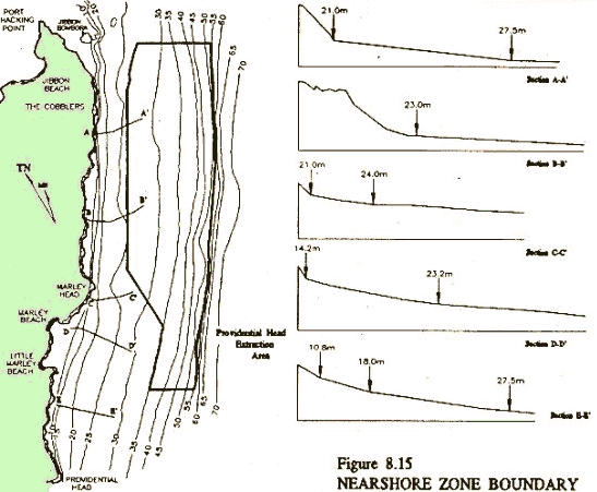
Recreational Boating "Port Hacking is a naturally shoaled, largely shallow waterway. The physical nature of the Port is intrinsic to its ecological and recreational value, providing extensive areas for fields of seagrasses which by their nature "migrate" within the port, colonising different areas of the port at different periods. These seagrass beds represent both breeding and nursery areas for fish, and also unique habitats in themselves. The gradual diminution of similar areas of shallow water elsewhere along the NSW coast makes areas such as the Port Hacking shoals increasingly significant.
The early explorations of the Tom Thumb soon after Phillip's settlement mapped this extensive shoaling. Its unsuitability for deep keeled navigation together with the rugged surrounding terrain left Port Hacking a relatively isolated region, and restricted residential occupancy and coastal industry. The unique nature of Port Hacking, as a safe swimming and recreation area close to the city of Sydney, is due in no small degree to these shoals.
Port Hacking is ideally suited to smaller vessels. The waterway is protected, there exists a number of points of interest and recreational areas accessible from the waterway, and competition with large boats is restricted to areas where there is sufficient depth for such boats."
Port Hacking contains unique areas such as The Basin, South West Arm, and the river from Grays Point to Audley. There is not an abundance of seagrasses, mangroves or salt marshes, so the plan argues for a conservation stance because of their significance in the biological health of the port. The demands of recreational fishing add considerable weight to this position. Consequently, extensions to conservation areas are proposed.
The nature of some areas creates conflict. The diversity of craft, and the proliferation of powered personal water craft (jetskis), has resulted in recommendations for activity separation, more effective policing, and in some cases, exclusion areas. Examples of this need are the mixes of power craft in family oriented wading and swimming areas at Darook Park in Gunnamatta Bay and at Bonnie Vale (Simpson's Bay). Other examples are the use of powered craft in areas such as The Basin, the anti-social behaviour of some users of jet skis and aluminium run-abouts, and the inappropriate speeding of large motor cruisers amongst small craft. Serious accidents have happened, some resulting in loss of life.
A consequence of various trends in boat ownership is that greater numbers of pleasure craft, ranging from canoes and surf skis to boats capable of extended off-shore passages, will be using Port Hacking in the future, even if the population of the Port's catchment was to remain static.
However, this trend in recreational boating should be viewed within the context of both overall recreational and boating trends. All forms of recreational use of areas such as Port Hacking are likely to experience continuing growth. Recreational activities such as bushwalking are undergoing faster rates of growth than boating. Similarly, within the range of navigational uses of waterways, it is the smaller recreational vessel uses which have undergone explosive growth whilst large vessel uses have developed more slowly, if more conspicuously. Windsurfing, the use of small sailing vessels, and small powered vessels, have become increasingly popular. |
Boating is fine, but...
As Sutherland Shire Mayor, Ian Swords states in his introduction of the Plan:
"..Navigational uses of Port Hacking are important. However they are but one of the many ways in which Port Hacking provides pleasure and benefit to the community. Provision for boating is one amongst many of the issues within the contents of the Management Plan....." |
|
Moorings
The use of the waterway includes, but is also seen to be constrained by, boat moorings. The plan argues that the Port's bays should not become parking lots for boats. It recommends non-intrusive approaches to mooring, which should create improvements for both boating and non-boating users of the bays.
Dredging & Sand Removal
The shoaled nature of the Port is described as its natural state, offering many benefits, but represented by some as a navigational impediment. Options explored by the Public Works Department are presented, along with the question of sand disposal. The Plan makes no attempt to offer a preferred position - the committee was not equipped to do so.
What the Plan does is set the parameters for any action. These parameters range from balancing competing uses, to ecological constraints. The Plan cites eleven essential issues for consideration by Council and the community in making any decision. Different parts of the Port offer a variety of possible solutions which can only be evaluated in the light of a wide range of detailed technical and social considerations, these ranging from engineering suitability and ecological constraints, to recreational potential and community preference. |
Shoaling: Dangerous and Unfair.
John Williams, Burraneer Bay Marina
I am extremely concerned regarding the shoal at Burraneer Point. There is now virtually no channel into Port Hacking. At dead low tide the level is approximately 600mm, which poses a dangerous situation to all but the smallest boats, particularly in weather changes, and could case loss of boats and life.
With vessels constantly going aground in the area there is a strain on volunteer bodies, Police, and NSW Waterways in performing rescues and removing boats that have run aground.
Waterways consider the channel is now unnavigable and refuse to place channel markers in the area because of possible damages claims.
While marine businesses on Port Hacking are suffering due to lack of appropriate Government corrective action, Government charges such as Dept of Lands rentals, fees, and similar, continue to rise. This is totally unfair. |
|
"Where to from here?"
The creation of the Plan of Management represents the best opportunity for many years to create an integrated approach to the management of Port Hacking and the resolution of conflicts and incremental deterioration which have characterised its past management. It provides a framework within which the many complex interactions and issues involved in the protection of the port's characteristic physical, ecological, and social values - (which benefit and are valued by all classes of users), can be addressed.
There is however a long way to go before the vision encapsulated in the Plan becomes a reality. Sutherland Council must achieve the operational and financial co-operation of the State Government, and a large number of government departments. The Plan is a means of putting a set of values in place and working towards them in a co-ordinated way. Achieving the standing and relationships with other bodies required to secure full co-operation is a major challenge in itself, and is unlikely to occur quickly.
This is only one of the challenges involved in achieving a co-ordinated approach to planning. The National Parks and Wildlife Service is moving towards a catchment management plan for the Hacking River. The Service's own management plan for the Royal National Park is also nearing completion. These plans have an obvious linkage with the Port Hacking Plan of Management, but the links between the various planning approaches have not yet been explored.
Also in the background is the proposal for the creation of a Marine National Park which has been put forward by the National Parks Association (The Curracorang Marine park proposal). Should this proposal be adopted by the government, it would have significant impacts upon the long term management of the Port.
When Sutherland Council took the decision to form the Port Hacking Planning and Advisory Committee, it took an important step in public participation by including citizen members .as well as relevant experts from Government Departments. While the very nature of the Port Hacking Committee will ensure its accessibility, the next step may be to have the meetings open to the public.
Public participation in the planning process is important for a number of reasons. No committee can presume to possess all knowledge on such complex topics. The community is also an invaluable source of history, local knowledge, experiences, as well as specialised skills.
Also, nothing remains constant. Situations change, new knowledge becomes available, the unexpected emerges. The plan is therefore a starting point", an "open " process, constantly under review. For example, global warming stands out as the great unknown at this time. Sea level rises are now almost universally accepted as inevitable, but the magnitude of the likely rise is the subject of debate among experts.
Neither should differences of opinion stand in the way of a unified approach to planning. The present Port Hacking Planning and Advisory Committee has made progress towards an agreed approach to the dredging of navigation channels. An approach supported by all interest groups and the community generally would make the securing of the neccesary funds from the State Government more likely than any dredging proposal which was not widely supported. This achievement in itself would more than justify the work which has been invested to date, and provide a model for the future management of the Port through consensus rather than through conflict.
A Plan still in process...
There are many challenges yet to come. Situations change, new knowledge becomes available, the unexpected emerges. The plan is a starting point, an "open" process, constantly under review. The Port Hacking Management Plan is simply the beginning of a lengthy process. A well co-ordinated approach to the planning and management of the Port will serve the interests of all users, and the broader community. Sutherland Council, and all those who have put in enormous efforts to achieve this worthwhile improvement in the Management of Port hacking, have been pursuing a noble intention. They deserve praise for their commitment and endurance. Helensbourgh Update -
Remember last year's lifetime opportunity?
Many hundreds of householders from around Port Hacking and environs joined the ranks of other well wishing inhabitants of the catchment last year in writing some 5000 letters of support to Wollongong Council urging that they press ahead with their April 1992 resolution to rezone 680 hectares of the upper Hacking River catchment at Helensburgh as "Environment Protected - Hacking River".
The community - wide lobbying effort was confirmation enough to the majority of Wollongong's aldermen that there were indeed unresolved dangers and environmental risks in proceeding with urban development in the National Park's and Port Hacking's headwaters. With this in mind, Wollongong Council formally adopted it's resolution to protect these areas, and another 6% of the Hacking River's catchment (17% of its most sensitive, mountainous, upstream tributary region is NOT in the Royal National Park) was soundly accorded the environmental protection it deserves.
Mediation in process
As this goes to print, 3/4 of the subject area of land has been zoned "Environment Protected - Hacking River" (7D). The other quarter, a 180 hectare rural area of bushland and farms extending south from Helensburgh to Lawrence Hargrave Drive (an area owned by 35 large and small landowners), has been earmarked for "mediation".
Under this process, an Independent Consultant (an ex - NSW Commissioner of Enquiry) is presiding over the conflicting claims and evidence from developer and environment interests alike as to whether this remaining area of 1000 potential homesites should be urbanised, or remain a distinctive rural bushland environment in keeping with Council's intention of protecting the Hacking River's headwaters by zoning it Environment Protected.
The likely fate of this rural farm and remnant bushland in the Gill's Creek catchment, (a tributary of the Hacking south of Helensburgh that flows into Kelly's Falls), is being decided by a Mr J Woodward. Mr Woodward was commisioned to the mediation role by Wollongong Council. His job is to pour through the many public documents and items of information that have been produced about this issue, meet with representatives of the various interest groups and experts, and, at the end of the process, send Wollongong Council a report recommending that it either rezone the 180 hectares into an urban area, or continue its existing rural / Environment Protected status.
At the process's inaugural public meeting at Helensburgh Workmans Club in late September, Mr Woodward told the largely pro-development gathering (environment groups boycotted the proceedings), that he had no fixed idea what course the mediation proceedings might take, though it would be difficult for him not to approve development if it could be proved that proposed stormwater management measures would prevent any impact on the Hacking River and the National Park.
"The question to keep in mind is what standard are we looking for," he said.
"If it can be established that by works there will be no impact on the park and the river, then it will be difficult for me not to approve development.
"If on the other hand, the standard is just to do it better than it's been done before, I'll be in no position to approve it. Just being able to improve on what we have now is not the benchmark we've been looking for."
Mr Woodward said that Sutherland Shire Council's Dr Garry Smith appeared to be the only person present at the proceedings representing a conservationist perspective. Woodward asked Smith, - Sutherland Council's environmental scientist, if he thought there might be a feasable solution that would safeguard the Hacking from the effects of urban runoff.
Smith said that sediment control might be a possibility, but in his experience, he was not aware of any successes to date with nutrient control.
A consultant environmental planner acting for development interests participating in the mediation proceedings then told Mr Woodward he was in a position to prove to Wollongong Council that urban development could proceed in the catchment and still satisfy the EPA's classification of the Hacking River as a Class P protected waterway.
The meeting ended on an agreed schedule of field days to be attended by representatives of the various groups and interests present at the meeting. If the outcome of the mediation process supports the expression of all those from around the Port Hacking catchment who indicated they were aware of what price upstream urbanisation was likely to have downstream, then this 180 hectare rural area will be protected as intended, and a robust community campaign to help Port Hacking seize its lifetime opportunity will have succeeded. |
The 5000 Strong Conspiracy
Apart from the concessionary precedent of a third stage of deliberation about a decision that many would remember Wollongong Council has substantially made twice in the last 4 years, there exist other more remarkable and unprecedented developments in this distressingly unrestrained regional environment dispute. A more extraordinary development a year after the latest "come and go" resolution to spare the Hacking from urban spoil is the legal precedent that a particular developer and land owner who wanted to double the size of Helensburgh is attempting to set, by privately sueing key players who took a front seat role in this very public and high priority conservation issue.
It's an extraordinary development because if it's successful in court, it must surely implicate anyone of the 5000 other members of the public who bothered to express their view to Wollongong Council. It's also extraordinary because those at the root of it have become obscenely self-confident in their rightousness and are now employing open and unrestrained civil-intimidation tactics alongside their legal strongarm ones. (See "The Donohoe's New Picket Fence")
Though his house hasn't been bricked up during the night just yet, Tim Tapsell, a hard-working Otford resident at the thrust of the Helensburgh community's 8 year wrestle with the consequences of its own urban growth, has received perverse recognition of his effort in galvanising thousands of expressions of public sentiment: Along with the imprisoned Donohoes, Tapsell is being sued "for conspiracy" for his part in the 5000 strong effort.
(Tim Tapsell was pictured in last year's "Port Hacking Protectorate" holding a 15 inch nugget of coal. The large though lightweight rock had somehow escaped through the very best finery and silt-traps of a variety of pollution and stormwater runoff controls in the vicinity of the Helensburgh coal mine and had managed to become part of the bed of the National Park's Hacking River many miles downstream of its coal mine source.)
Tapsell's litigant is a Mr Bob Hogarth, the principal of a company with large real estate interests in the bulk of the land now zoned Environment Protected. Mr Hogarth was one of the major landholders to have his development hopes thwarted when Wollongong Council decided to maintain its Environment Protection zoning. Mr Hogarth's interests totalled an area of land representing some 1200 building sites to the east of Helensburgh toward Lilyvale and Otford.
In their endeavours to have the subject land zoned urban over many years, Mr Hogarth's associated companies (Ensile Pty Ltd and Lady Carrington Estates) have displayed a colourful and boisterous past. Much of this colour has been featured in regional Illawarra newspapers and TV footage in years gone by. A lot of it was summarised in a chronology in the previous edition of The Protectorate, (October 1992).
To keep up the good track record, Ensile Pty Ltd and Lady Carrrington Estates are now suing Jim and Jenny Donohoe of the Helensburgh District Protection Society, and Tapsell (Secretary of the Friends of Hacking River), for their parts in a conspiracy "to destroy the financial and commercial interests of the plaintiff."
The writ that could also apply to anyone of the 5000 other conspiratorial members of the public who engaged in parts and parts thereoff of the following list of charges by informing a local government body of their opinion on an issue, is reproduced below:
"In pursuance of the said conspiracy, the defendants did the following overt acts:
-
On or about December 1992, the defendants forwarded letters to the Wollongong City Council promoting the rezoning of the rural land around Helensburgh to 7(D) Environment Protection, Hacking River, the effect of such rezoning is to prevent the Plaintiff from developing the Lady Carrington Estate, and the defendants were aware of that effect and sought to achieve that effect.
-
On or about December 1992, the first and third defendants authorised the printing of a letter adddressed to the Wollongong City Council promoting the rezoning of the rural lands around Helensburgh to 7(D), Environment Protection, Hacking River.
-
On or about December 1992 the first, second, and third defendants arranged for approximately 1085 people to execute copies of the letter refered to in sub-paragraph above to the Wollongong City Council.
-
On or about 17th December 1992 the second defendant delivered the letters referred to in sub-paragraph above to the Wollongong City Council.
Despite the above-board public nature of the tasks he is now facing charges about, (Wollongong Council itself had exhibited the Environment Protection proposal and had called for public submissions about the re-zoning), Tapsell says the lawsuit looks like costing him several thousand dollars in legal fees at the outset to mount a mandatory "defence". He says several lawyers have contacted him about the case, news of it having quickly travelled by word-of-mouth among some members of the legal fraternity. |
|
A Rolls Royce of a Failure -
Sediment Traps in Helensburgh
When Wollongong City Council rejected the Helensburgh expansion Plan in favour of protecting the Hacking River and the national park in April 1991, it did so recognising that there existed the potential for a 40% growth in the size of the town just from in-fill and medium density development of undeveloped vacant building lots already situated in the town's present urban zoning.
A major developer of some of these areas has been the State government itself, via Landcom. To its credit, Landcom has taken the proper care to construct model drainage silt traps to contain stormwater sediment at all points downstream of its development. The silt traps are accompanied by "state of the art" sedimentation basins consisting of earth bunds around the perimeter and silt screens made of hay bales and shade cloth. The sediment ponds are designed to settle all that which is not filtered out by the silt traps, and in this way, prevent pollution further downstream in the Hacking.
Despite the failsafe assurances these facilities always come with (especially when they are part of less well-founded urban development or rezoning applications situated in high risk topography, or near sensitive downstream environments), the 180 block sub-division and its associated pollution control measures met their mark on 12th to 14th September when three days of Helensburgh rain poured down 120 mls of water (5 inches) , and created a haemorrage event with the disturbed, saturated soils that engulfed the silt traps and unleashed a major spill from the Frances Street pond.
Tim Tapsell, who photographed the spill, says the Hacking River cannot tolerate any more siltation, as it was already ankle deep at Audley. Though most pollution control devices installed to date on all major development and industrial sites in the region had failed at one time or another, the Environment Protection Authority he said, were maintaining the fiction that technical devices such as these were capable of protecting national park river systems from urban stormwater runoff by conducting a routine investigation into the natural violation incident with a view toward prosecuting the Dept of Housing.
"If land abuse continues at Helensburgh the river will become a stretch of marsh instead of a deep flowing river," Tapsell says
"We're continually promised Rolls Royces, but we keep getting lemons." Total, and Not So Total, Catchment Management Plans
Vic Lieuliette
The Hawkesbury River has an overall length of 200 kilometres, starting as the Wollondilly in the Goulburn area, and being joined by the Cox, Nepean and Colo Rivers. Its management falls under 26 Acts of Parliament, eight Ministerial portfolios, 15 State Government Departments and agencies, 13 local Councils and 160 Aldermen and Councillors,- (SMH 9.6.92).
Flowing northwards for most of its course before turning eastwards towards the ocean (like the Hacking), it passes through many different landforms. Many waterways flow into it, on either side, and it is subject to many land uses..
By contrast, the Hacking River is short. Rising on Maddens Plains, it drops at Kellys Falls into a deep valley which only widens at Grays Point to form the estuary we call Port Hacking. Its tributaries, mainly on the left, are also short, as the catchment area is narrow. And the land uses of the Hacking Valley are few in number.
My file on the Hawkesbury - Nepean begins with a document which summarises a Draft Regional Environmental Plan issued when Bob Carr was Minister for Planning and Environment,- (ie: some time before March 1988). It foresees most of the problems which have since become obvious, but expresses no real urgency in its text. Which only goes to show how rapidly events move as they approach a critical point.
The above plan (now REP 20) is refered to in a discussion paper dated November 1991: "The Hawkesbury - Nepean: Catchment in Crisis". Garry West, Minister for Conservation and Land Management, in his preface, writes of "the bipartisan State Policy of Total Catchment Management (TCM) as the basis of the solution."
In that article, A Catchment Management Trust is proposed for the river system, but its next mention is in the Sydney Morning Herald (SMH) on 4.8.93 (yes, '93!): "The Trust ...will be responsible for the ....rivers below the spillway of the Warragamba Dam....and did not include the catchment area from the dam to Goulburn..."
So much for the concept of TOTAL catchment management!
Hawkesbury today, Hacking tomorrow
Apart from some anxiety over the adequacy of Warragamba Dam and its spillway in the event of an abnormal rainfall, - my file contains much material from the SMH about outbreaks of toxic algal bloom, and the expected impact of mass housing areas at Scheyville, South Creek, and Rouse Hill.
To what extent may we fear that the fate of the Hacking catchment may repeat the perils of the Hawkesbury River system? The Maddens Plains area was proposed for mass housing in the heady days of the mid 1980's;- this remains in abeyance. The saga of Helensburgh - (downstream, but still in the Hacking's headwaters), may not yet be over: As someone said, all that environmentalists really succeed in doing is to obtain a stay of execution, not a pardon.
Meanwhile, Gills Creek (beside Kelly's Falls) remains under long term threat: its tiny catchment is earmarked for various potential zoning uses. (At the time of writing, a Commissioner is discussing the possibilities with interested parties,- despite Wollongong Council's most recent avowel,- (the third)- that the area should be zoned Environment Protection.
Camp Creek at Helensburgh still hosts the Metropolitan Colliery, while it and Gardiner's Creek carry the "urban runoff" from the town itself.
The boundary between the City of Greater Wollongong and Sutherland Shire crosses the Hacking Valley a little downstream of Helensburgh. Until recently, it has been felt that some of the Wollongong Councillors were not much concerened with environmental consequences if the proposed enlargement of Helensburgh went ahead, as the impact would only be felt beyond their area. But, happily, people learn from experience, and community standards change. Still, the pressure to develop various privately owned lands remains.
Royal National Park and the Garrawarra State Recreation Area beside it ,are relatively pristine. Left bank tributaries of the Hacking, such as Cawleys Creek and Kangaroo Creek (which enters the Hacking at Audley), receive a certain amount of pollution from the transport corridor along the Princes Highway watershed which has the Woronora valley on its west.
Audley itself, where the causeway marks the transition from fresh to salt water, is not at present a source of much pollution. But let us beware! In seven years time the Olympic bicyclists races will be held in the area. "Facilities" and "amenities" will HAVE to be built, and on a massive scale, oblivious to the fact that they will be white elephants after unless somehow converted to a useful purpose for the long term.
So the water of the Hacking River is relatively uncontaminated as it enters Port Hacking. And it remains so on the south side, where only the small townships of Maianbar and Bundeena contribute runoff. But the bays on the north shore are a very different matter. Nearly all of the peninsula, from Sutherland to Cronulla, is residential, and increasing density will aggravate this situation.
Roads, roofs, concrete surfaces, all these prevent rainfall from penetrating the soil. Vehicles, animals, and litter all foul the surfaces and contaminate the runoff. Rainfall following a dry spell scours the gutters and empties the drains. But the twice daily tidal flush dilutes and carries away the polluted water and its solid cargo.
Therefore it is very unlikely that Port Hacking will experience an algal bloom - though in some small areas at the heads of bays it might occur. But undoubetedly around stormwater drains the seawater is highly contaminated, and many years will pass before safe levels are attained, even with considerable expenditure.
In the meantime, the entire catchment of the Hacking needs to be regarded as a single unity, from Maddens Plains to Bate Bay. Even informally, the environmental impact of what NOW exists requires studying, (let alone what further developments might be proposed).
The Hacking River Catchment Management Committee had its first meeting early in October. Note the apparent absence of the word "TOTAL"! Will its area of interest include Port Hacking, or not? For if river and estuary are to be separated, trouble may well lie ahead. Partial solutions only breed further problems. |
| The boundary between the Wollongong City and Sutherland Shire Council Local Government Areas is a topographically irreverent dotted line on a map that disects the Hacking River Valley into politically distinct upper and lower catchment areas, a difficult formula for whole catchment environmental responsibility. |
|
Hacking Catchment Committee: Mark 2
Max Kelly
On Friday 8 October the new Hacking River Catchment Management Committee met for the first time. It 's had a long pregnancy.
The new committee comprises representatives of the National Parks & Wildlife Service (NPWS), the Port Hacking Planning & Advisory Committee, the Environment Protection Authority (EPA), the Port Hacking Protection Society, the Royal Motor Yacht Club, Wollongong Council, Sutherland Council, the Department of Conservation & Land Management (CALM). the Water Board, and various community members, as well as large and small private landholders. The Bushwalking Confederation of NSW is also represented on the panel.
The congregation is actually the second catchment management group to be convened for the Hacking River system in the last five years. The first, established in 1989, was an "ad-hoc" one focused on the upper catchment, and had representatives of the Soil Conservation Service, the Department of Planning, the State Pollution Control Commission (SPCC), the NPWS, Wollongong and Sutherland Councils, as well as Helensburgh Progress Association and the Helensburgh District Protection Society.
The 1989 Committee produced an ad-hoc Total Catchment Management Report for the river, one of its clearer recommendations being that a new committee be formed "within six months" to put the plan into action. Now, in October 1993, the Committee has been formed. The delay was the result of bureaucratic inactivity, of changes of government, and to a certain extent, a lack of positive motivation within the catchment itself.
The meeting was convened by the Environment Protection Agency in conjunction with the National Parks and Wildlife Service, and held at the latter's Audley Office. Dr Neil Shepherd, Director-General of the EPA gave the opening address.
Shepherd noted that the Total Catchment Management (TCM) Act of 1989 grew from a recognition that State-wide, water quality was declining and that catchment environments were being seriously degraded. Past "engineering solutions" had provided a far too limited approach to water quality. The new TCM approach is aimed at providing a much more comprehensive, co-operative approach to water management, one in which all the players involved - the community, the local government agencies, the land owners, the developer, the environment groups - should all be involved to achieve sustainable, high quality control. Shepherd stressed that the Hacking River Committee, given its "considerable degree of power" must "get in there and tell the government agencies what is going wrong".
In essence this is the brief for the committee. The EPA has already identified numerous critical areas in regard to the Hacking River - dredging, seepage from septics, Audley weir as an obstacle to fish migration, marina and boat cleaning activites, the pressure for urban development, colliery impacts, soil erosion, bushland cleaning and so on. The job is huge, especially since Shepherd reckoned that a plan, with teeth, should be devised within twelve months. One especially critical area will be co-operation between the Committee and Sutherland and Wollongong Councils. Co-operation is essential to success.
Problems abound in the Hacking Catchment. The continuing saga of Helensburgh housing development is just one of them. So too is an actual definition of the catchment area itself.
The committee - whose membership is diverse with a strong emphasis of community representation - will meet once a month. At its first meeting the energy was certainly there. Let's hope that energy levels remain high for, finally, there is now the possibility for an integrated, sensitive and environmentally-based approach to the management of the Hacking Catchment. Sucking Sand From the Sea
A commercial sand mining company owned by Pioneer concrete and CSR investments has applied to remove 50 million tonnes of fine and general construction sand from an eight square kilometre area of the seabed floor off the coast of the Royal National Park and Port Hacking over the next 50 years. The proposal is one half of an ambitious sand mining operation also planned for a similar sized area extending from the Kurnell/Bate Bay area to Maroubra. Both schemes are currently being exhibited as part of a detailed Environmental Impact Statement about the mining proposal on public display until November 19. (1993)
The sand mining proposal affects an area from one half to two kilometres offshore from Port Hacking (Jibbon) Point, south to Marley and Little Marley beaches and Wattamolla. The long term operation proposes to remove approximately 5 metres of sand from the seabed floor of this 7.4 square kilometre area,- an area that presently ranges in depth from 25 to 55 metres. The EIS says this five metres of sand represents the top layer of a lengthy underwater "dune" of sand some 20 to 30 metres thick. |
 |
| The proposal envisages a specially equipped vessel about one third the size of a typical container ship, with a long suction conduit attached to its side designed to "skim" the sea floor in furrows about 1.7 metres wide. This technique is expected to cover approximately a hectare of the seabed floor for every 6 kilometres travelled by the vessel,- an operation the proponents say will fill the ship's hull to capacity (3000 dry tonnes of sand) in two and a half hours. The vessel then returns to Port Jackson to unload the mined sand, each return trip taking approximately 12 hours. |
 |
The EIS says that the sand extracted from the sea floor will be sucked up the vessel's sand pipe as a water / sediment slurry, the bulk of the water conveying the sand then being released through a secondary diffuser pipe trailing the ship about 10 metres below sea level. It says that fine sediments in the excess water would form an under water plume that would be "dispersed to background concentrations" (ie of milligrams of sediment per litre of water) "within 16 to 24 hours".
The study documents dominant wave patterns and current directions in the vicinity of the extraction area. The dominant currents are said to flow parallel to the coast with an average speed of between 1.5 metres per second at the surface, to less than .2 m/s near the seabed floor. The proponent predicts that the impact of this current on the dispersal of the excess water and sediment slurry is likely to generate an "underwater sediment plume" up to 170 metres wide in the sea water behind the extraction vessel, "not visible at the surface":- "The plume would rapidly disperse and be transported by ambient currents parallel to the coast or offshore, " the summary document reads. "If considered necessary, the applicant could cease extraction in the rare event when offshore currents exist...The proposed depth of release would ensure surrounding shipwrecks and biota on the seafloor are not adversely affected by the fine sediments,- the bulk of the fine sediments would move slowly to more tranquil areas in deeper waters of the coast." Sea-bed Fauna
The EIS measures the impact of sand extraction upon fauna living on or near the sea floor by evaluating the likely frequency of the vessel's runs over it with the 1.7 metre wide extraction furrow.."The impacts of extraction upon the fauna would be severe for a period (1 to 3 months) until re-colonisation occurred." The summary document says that re-disturbance wouldn't occur prior to this period of time. Elsewhere it describes benthic fauna "on and within the sandy sea floor" in the vicinity of the extraction area, adding that "detailed studies revealed the increasing abundance of benthic fauna with depth", this possibly reflecting"the decreasing natural disturbance of the sea floor with depth". What's it Worth?
The extensive sand resource to be removed over the 50 year period (from both this extraction area and another of the same size offshore from Botany Bay and the eastern suburbs beaches), is said to be worth $1000 million, with expected State Government revenue of $100 milllion. The applicant is Metromix Pty Ltd, the current operator of one of two diminishing sand mines at Kurnell, and a joint company of Pioneer Concrete and CSR Investments.
Interestingly, and with little in the way of public explanation, a State Commision of Inquiry is to be held into the exhibited proposal immediately after the cessation of the EIS's public comment period. In an official notice placed by the Department of Mineral Resources notifying the public of the EIS's exhibition (in the Sutherland Shire Leader on October 19), a subsequent Commission of Inquiry "independent of any Governemnt Agencies" was announced. The Notice said "the Minister for Mines will determine the application after considering the findings and recommendations of the Inquiry"
According to the notice the Minister for Planning has directed that the Inquiry take place. The notice also says that all written submissioions on the EIS will be refered to the Commision of Inquiry, and that time would be provided for those who wished to formally present their submisions for hearing to the Commision. The address to send submissions in response to the proposal and the EIS is The Director General, Department of Mineral Resources, PO Box 536, St Leonards. 2065. These must be sent prior to November 19
Beach fears
The proposed sand mine extraction area off the Royal National Park sits firmly within the two mile offshore buffer area proposed by the National Parks Association (NPA) for incorporation into a marine national park,- (The Curracorang Marine National Park proposal. According to a recent report in the Sutherland Shire Leader, this proposal was to have included the waters of Port Hacking.)
The NPA's Marine National Park proposal was prepared at the outset by Wollongong University Professer of Coastal Geography Ted Bryant, prior to 1990. In a response to the granting of mining exploration licences for the intended extraction areas three years ago, Bryant was reported as saying that the seabed floor off the Royal National Park was characterised by several long offshore sandbanks up to a kilometre long and several hundred metres wide.
He said that an exchange of sediment and inshore sands from beaches and coastal waterways as wide apart as Port Hacking and Bass Point near Wollongong was possible if these sandbanks, which were sometimes up to 30 metres deep, were mined. The current proposal by Metromix intends to remove five metres from the top of these sandbanks over the next 50 years.
"Beaches along the coast are formed by the direction of the waves coming in," he said
"If these mounds are removed you will be altering the direction of wave lines coming into the shore from up to 10 kilometres away. In the UK, beaches began to erode 30 years after offshore sandmining because of alterations in the seabed topography affecting wave refraction patterns."
Professor Bryant said that any offshore sand mining proposal should have to prove it would not be exchanging sediment with the shoreline and that wave refraction patterns would not be affected. |
Sutherland Shire Foreshore Building Plan
Max Kelly
The Port Hacking Protection Society has attended several community based meetings called by Sutherland Council about the problems of properties affected by a Foreshore Building line. As a result the Council is now preparing its final plan - to be publicly exhibited - which will become a part of a Shire LEP.
There was considerable alarm, particularly from waterfront property owners, when this Council initiative was first mooted. Of real concern was the possibility of the removal of structures already built below the Foreshore Building Line.
It appears that such fears will be largely groundless, although in certain instances totally inappropriate and poorly maintained structures - structures wholly detrimental to the aesthetic and environmental quality of the waterways - will have to be removed. A mechanism to ensure this, is likely to be included in the Plan..
Apart from this, the foreshore building plan promises to be a sensitive and reasonable approach to the maintenance of a balance between the environment's built form and its landscape. The foreshore surrounding Port Hacking, - the spectacular landscape combination of stone outcrops and native vegetation - is one of the area's unique features. Yet, on some occasions, insensitive development of buildings and structures (eg, "greedy" shoreline swimming pools and the like), have shattered the harmony of the area. It is in order to prevent such intrusion that the foreshore building plan is being formulated. There are at present some noteable examples of private boat ramps on the foreshore extending across the public way.
In a similar fashion, development applications involving dual occupancy and medium density subdivision of waterfront areas must pay particular attention to the location of any new structure, its architectural character, materials and scale. Landscaping must be compatible with the character of the native vegetation,- eucalypts, angophora, and so on. In such a fashion visually intrusive blocks of buildings cascading down a site to the water, devoid of softening vegetation, will be be avoided.
The Foreshore building line is not meant to be a rigid document that dictates all the terms. It is intended to provide a framework within which decisions can be made, recognising that each site, each area involving the foreshore building line, will have unique qualities requiring individual attention. The overall result should be a greatly improved balance between the built and the natural environments,- a balance in keeping with the character of the waterway. In the meantime though, only vigilance, environmental concern, and time will tell us, (as always), whether these good objectives become reality. Shire Floor Coverings
S Ward
One of the more pressing impacts of an urban area on a nearby waterway's water quality comes from the brew of urban runoff that escapes the developed area's kerbs and gutters and stormwater drains.
Such things as the population of the area, the amount of traffic it attracts, its congestion, the area of the sealed built environment it commands - (roads, paths, rooftops etc), as compared to the area of open filtrative soils and tree cover that it formerly had, all these (and more) have a direct bearing on how olluted or sediment-laden an area's urban runoff water is, and how fast such an area contribute to the poisoning and degradation of its associated waterways.
Over the past year in Sutherland Shire a debate has grown regarding the amount of medium density and dual occupancy type development Sutherland Council is prepared to permit in the Shire. Concerns from the community expressed to date argue that Council is permitting too much over too wide an area - one consequence of this being that the Shire's leafy character (a characteristic that many people will asociate with the place that they chose to live at), is disappearing fast as both mature original native trees are removed from old quarter acre home blocks to make way for the new, more concentrated densitioes of site development now allowed, (indeed, enforced) by the State Government.
The State Government argues that such measures are essential if Sydney's unrestrained outward growth and its associated cost to the environment is to be addressed. These environmental concerns include the clearing of fringe metropolitan bushland, urban development over the city's prime market-gardening and horticultural areas, and excessive private motor vehicle dependency and pollution as suburbs move further and further away from existing public transport services, employment, and social centres. These are marco environment problems concerning all of Sydney, the State Government says.
But macro usually impacts on micro, and in Sutherland Shire, a LGA with an above-the-average area of its land zoned for greater densities of development, (a greater area than the State Government originally required o all Councils), the local problems raising their head aren't just the expected concerns about tree loss. They include concerns about increased traffic, increased demand on car parking facilities, and ailing transport, sewerage and drainage systems not designed to cater for the greater use of an increased, though not expanded, local population. Another of the issues has been the Shire's apparent planning indifference to whether the urban consolidation process should continue to be allowed uncontrolled throughout the Shire where it naturally gravitates to the more leafy and "desirable" outer areas where car travel is usually mandatory. (These are the very areas where the real estate market is mantonly hunting for development opportunities, and they are usually the places with the most valuable tree stocks.)
In Sutherland Shire,limp tree preservation powers that worked OK when the more merciful quarter acre block mentality reigned supreme, (when a surplus of one or two extra tress didn't necessarily get in the way of things), have finally met their match. The combination of Sutherland Council's "de-regulated" approach to dual occupancy and medium density siting (now starting to get a look in at least), and the enterpreneurial lead taken by enterprising developers and estate agents using the new possibilities as they were intended by the State Government, has had a dramatic impact on the Shire's "floor covering" with two houses suddenly appearing in places where there were previously one, anywhere in the Shire.
At its most extant, Sutherland Council was hiring extra staff to cope with the overload of work created by the daily receipt of unprecendented numbers of development applications - the majority of them new dual occupancy, town house, or villa applications! (The Leader newspaper reported the daily figure and the Council General Manager's remark about it in an article about the phenomenon, though, clearly, this was a story about a trend one would have thought plainly visible by the number of advertisements in that and many other current editions of the same newspaper for "free dual occupancy advice", seminars, or "opportunities for sale", etc. from the many development firms anxious to coerce more Shire residents to "double-develop their block.)
At the height of the debate that has grown abou the issue - (an issue with an important context that both sides are making scant reference to, ie. that Sutherland Council's allocation of area to this kind of development had already been greater than most other comparable Local Government Areas around Sydney), real estate interests publicly attacked Sutherland Council for making a start on guidelines to control the impact of, the pace, and the direction in which the Shire's contribution to Sydney's urban consolidation was heading. (The criticism got the Leader's front page on 14.10.93..., just ahead of the ads...)
If the page one real estate agent's anger at the "threat" to his industry was a purposeful editorial placement put there for its provocation value, the article worked well, for a small torrent of letters were printed in the next few editions - most of them decrying the unabashed self-interest of the comments and the industry making them. Many of these letterwriters also described the physical impact that present levels of dual, medium, and village development were having in the Shire, again, the obvious claims about declining tree cover. |
 |
Bring Your Own Bait! |
 |
Intertidal Protected Areas in Port Hacking
George Harrison
The NSW Fisheries Department has banned the collection of invertebrates from two areas of Port Hacking. The areas are Boat Harbour, from the Merries Reef to Potter Point (where the Cronulla Sewerage Treatment Plant's outfall is located), and at Cabbage Tree Point, from the Bundeena ferry wharf west to the Eastern end of Simpsons Bay.
From July 9 the collection of all invertebrates, such as periwinkles, sea urchins, kunjevoi, etc, with the exception of rock lobster and abalone, has been illegal in these "Intertidal Protected Areas", (IPAs).
This follows concern about the general health of rock platform life. Bag limits expressed as volumes (eg: one 10 litre bucket), were introduced in 1988, but were found to be ineffective. Limits are now expressed in numbers (eg: 20 limpets or chitons, 50 pipis or cockles), and the IPAs have been located to enable invertebrates to recolonise other areas.
Fisheries have recognised that intertidal shellfish are considered delicacies amongst certain ethnic groups, and will make attempts to take its message to the areas where these people are concentrated.
Sutherland Shire Council has approached Fisheries to train some of its Ordnance Officers to supplement Fisheries Inspectors in policing the new regulations. The Port Hacking Protection Society has written to Council suggesting that multi-lingual signs, along the Queensland model, be erected in appropriate areas informing people of the ban, and the substantial fines (up to $10,000 ) for infringements.
BYO BAIT! The Department of Fisheries has been quick to point out that fishing is not prohibited in the listed areas, though anglers must bring their bait with them. Nippers (yabbies) and blood worms may still be taken by pump or shovel, though not in areas of saltmarsh, seagrass, or mangroves. Copies of the new bag limits (Fishnote DF/28) can be obtained from the Department of Fisheries. You may report illegal fishing or shellfish collection by phoning Fishermans Watch 008 043 536 New Navigation Aids the Port
Port Hacking has some new courtesy lights. Three new starboard navigation aids have been installed near Lilli Pilli point to mark the vicinity's shifting sands. A light has been installed on the east cardinal mark at Gogerlys Point. Two starboard piles have been replaced in the Gunnamatta Channel, one port pile at Point Danger , and one new starboard pile at the entrance to Fisherman's bay.
Jetskis Banned From Bonnie ValeThere's a little piece of peace in the Port on the horizon. Jetskis are to be banned from a special exclusion zone in Port Hacking at Bonnie Vale. The Port Hacking Protection Society is represented on the Waterways Authority's "Port Hacking Users Group", another local waterway body which meets once every three months. Other members of the Users Group come from the Volunteer Coast Guard, the Royal Motor Yacht Club, the Cronulla Sailing Club, Dolans Bay Marina, the Jets Sports Association, and the Fisherman's Advisory Council. Margaret Roberts (Botany Bay / Port Hacking Waterways Authority) chairs the meeting, along with two of her officers.
A prime concern of the Society on this Committee has been the vexed problem of jetskis (formerly known as personal water craft), especially after the outstanding response we had to the anti-jetski petition in October last year. Roughly 1500 signatures from around Port Hacking were obtained, this resulting in a PHPS delegation to the general manager of the Maritime Services Board's Waterways Authority.
The Authority promised an investigation to find a zone to which jet skis (generally agreed to be the most destructive element currently using the waterways) could be restricted. This would be as a compromise position since the Port Hacking Protection Society was arguing that a ban on these totally intrusive machines was the only way to restore peace to the Port.
Three Waterways Authority officers, plus Lance Turnley of the Jet Ski Association, conducted such a survey, only to report that "a suitable location could not be found".
In spite of this distressing (and, really, unconvincing) outcome, there has been some progress. At the instigation of the Society, and with the total support of the User Group and the Waterways Authority, it has been decided that an exclusion zone is to be implemented at Bonnie Vale. The Waterways Authority is to mark a zone with yellow buoys within which jet skis and other power driven vessels must not operate. The area is to be for swimmers and passive recreationists only. A channel will be left for vessels to have access to the current informal boat ramp. Signs will be erected to warn vessels of the exclusion zone.
As this is an extremely popular picnic area for families with children, the move is indeed very positive. Accidents, several of which have happened here in the past, will now be avoided. And the aggressive, noisy activities of the mindless jet-ski rider will be curtailed!
Freeway Threats to Port Hacking
Adapted from an Article by Michelle Zeibots, SSEC
Despite press releases and articles in local newspapers promising that parts of a 43 year old Shire freeway corridor planned to pass through sections of the Royal National Park would be lifted in 1989 and returned to the park, the State Government has still not officially gazetted the return of a section of this former DMR - RTA reserved land adjoining the village of East Heathcote to the Royal National Park. |
 |
Many residents of Sutherland Shire and Port Hacking will never have heard of the F6 freeway. The RTA doesn't often promote the proposal. This is not surprising given the controversy currently surrounding other freeways around southern Sydney.
The F6's six lanes of concrete and ashphalt enters the Sutherland Shire at Taren Point Bridge and cuts diagonally across the Shire along a ribbon of open space, parkland, and playing fields in between houses from Sylvania Waters to Kirrawee. The freeway enters the Port Hacking catchment between Miranda and Gymea, crosssing The Kingsway near Sylvania Road, and then President Avenue and North West Arm Road where it cuts across the Dents Creek Valley entrance to Grays Point with a section of elevated freeway. From here the freeway reservation proceeds westward through the newer areas of Kirrawee adjoining the national park, putting much of the suburb's bushland and "public reserves" under concrete.
From south of Kirrawee to the vicinity of the present National Park entrance at the junction of Drive and the Princes Highway, the freeway route lays claim to yet another 6 lane swathe of the Royal National Park a quarter of a mile inside its northern perimeter parallel to the Sutherland bypass road,- (ie, the Acacia Road Kirrawee, to Princes Highway, Loftus, "freeway") .
The Acacia Road route was the last excision from the park of this style. Ironically, the F6's "dedicated" corridor duplicates this twenty year old effort in both route and scale, leaving a trapped portion of the Royal National Park's northern bushland sandwiched between the two, 6-lane freeway style roads like a remnant traffic island.
This expressway-prone area of the park discharges into the Port Hacking River via Sevilles and Temptation Creeks. As well as the obliteration of a significant area of park bushland, water quality would also be degraded with increases in urban run-off and sediment from the road's construction entering the river.
From Loftus the original route of the F6 freeway corridor can be seen on old street directories as a broken line largely inside the perimeter of the Royal National Park and parallel to the north south direction of the Princes Highway. It was a mile-length portion of this route to the east of the village of East Heathcote that politicians promised the RTA would hand back to the National Park in 1989. The headline-attracting gesture secured its public relations intent, but clearly a mile of something six lanes wide adjoined at either end by a few more miles of the same voyaging north and south inside the National Park's western perimeter is not something you give up lightly, particularly when its obviously an essential part of a single freeway thoroughfare designed to link the F6's terminus at the Audley turnoff with the Wollongong tollway at Waterfall.
As with other radial freeway proposals around Sydney, the rationale for eventual completion of the F6 is to facilitate car dependent subdivisions on the outer edge of the metropolitan area. The Port Hacking River system, which feeds the Royal National Park, is already deteriorating under the strain of urban runoff, siltation, and weed infestations from existing subdivisions at its headwaters. Pressure for further subdivisions at Helensburgh and at Maddens Plains above the Illlawarra escarpment would be inevitable if the freeway were built, creating the spectre of a continuous belt of suburbia between Sydney and Wollongong that also surrounds the Port Hacking River and Royal National Park catchments. These are preventable nails in an undeniable environmental coffin.
Who Wants to Build It?
Indications that the F6 freeway has moved beyond its dormant reservation phase onto the planning and construction agenda come from a variety of sources, not the least of which are a completely new set of traffic pressures inflicted on the Rockdale municipality by a major modification to the RTA's plan for the terminus of the controversial south western freeway (the M5 tollway) south of the airport in Northern Rockdale, rather than continuing it through to the city via Alexandria as has been forecast for many years.
In a move some critics say is cynically contrived to exert traffic pressure (and thereby political support) for an expedient F6, the realigned M5, - (an RTA road route that has survived ten loud years of attempts by Wolli Valley locals to stop it, and which during that time has always pointed in a straight, north easterly direction from Liverpool to Tempe and thence to the city),- now turns suddenly to the south near Arncliffe, and terminates at the northern extremity of the F6 freeway corridor that slices through the Rockdale municipality from the airport to the Taren Point Bridge!
Apart from this unnannounced development, Sutherland Shire Council planners are currently considering construction of a section of the F6 freeway between the Kingsway near Gymea and The Boulevarde. The ratioanle for this is that it will remove traffic congestion near Westfield at Miranda.
Is It Nessesary?
It is well known and widely adccepted within International transport planning circles that freeways do not reduce traffic congestion. One only needs to look at Los Angeles,- the freeway capital of the world,- to see the self-perpetuating process that freeway development is. In a similar way, Shire planners considering the construction of a section of the F6 to alleviate shopping centre congestion at Miranda have failed to consider that one logical impact of the completed freeway is that it will increase the catchment area of potential shoppers!
There has been a lot of public debate in other Sydney communities about what type of city people would like to live in. If reducing traffic congestion and improving the amenity of the Shire's streets and centres are serious local planning aims, then an approach other than sweeping traffic "under the carpet" to some other place is needed,- especially when the carpet being trashed is an area like the Royal National Park and Port Hacking.
What is needed is a concerted shift away from road building toward public transport. Much of the traffic travelling along Sydney's southern axis has destinations at the airport or the Central Industrial Area of Sydney at Alexandria - Botany. The proposed Airport Rail link, a public transport alternative to the F6 freeway, would give Sutherland Shire commuters direct rail access to the Airport and central industrial areas of Sydney via the Illawarra and Cronulla lines and a rail interchange at Arncliffe. Similarly, recent Rail Union arguments for link lines between Mortdale & Hurstville and Bankstown, and Carlingford to Pennant Hills, - would remove hundreds of thousands of unneccesary vehicle movements per day from Sydney's traffic-choked arteries while efficiently re-orienting Sydney's rail system toward its growing demographic and employment centre in the Parramatta - western suburbs region.
There is also the potential for light rail lines (modern day trams) to be introduced to the Shire's transport network. Many Local Government areas throughout the Sydney metropolitan region are investigating ways that light rail systems could be introduced to their districts. In many cases, existing freeway corridors would make picturesque public transport routes for these low impact, highly efficient, people-moving modes of transport. Sutherland Shire would seem a particularly opportune place to put such systems into practice, there already being a working length of tramway in the Shire operating from Sutherland to the Royal National Park,- (The Loftus Rail museum)
If you would like more information avout the F6, pick up the "Railways Not Freeways" information Kit for $5 from the Sutherland Shire Environment Centre, Suite 16 , Eton Arcade, Sutherland. 2232, or have someone come out to talk to your community group about the issue, by phoning the Centre on 9545 3077. (A slide show and discussuion can be arranged). An Oil Spill in Port Hacking -
What's the Chance?
George Harrison
The Environment Protection Authority (EPA) has warned of dire consequences for Port Hacking in the event of an oil spill. The EPA has prepared an advisory atlas of large sections of the NSW coast to help deal with contingencies arising from oils spills .
The document lists features of particular sensitivity in Port Hacking. The extensive sandbars support waders and act as resting sites for migratory birds. Grays Point and Cabbage Tree Basin boast the only mangroves in the area (Barrenjoey Head to Bellambi Point) covered by the atlas. An area of rare saltmarsh occurs behind the mangroves in Cabbage Tree Basin. Seagrass beds in Port Hacking are often found in very shallow waters and at low tide would be exposed to floating oil.
Whales visit the port an waters off the adjacent coastline seasonally, dolphins throughout the year. Seals, which are particularly at risk with their fur clogging, (leading to loss of insulation), and from ingesting oil contaminated food, are occasional visitors. Green and leatherback turtles have also been spotted in the area.
Commercial and recreational fishing would be severely affected by oil spillage. Perhaps more importantly, the upper reaches of the river have been definitely identified as a breeding or nursery area for jewfish, luderick, and bream. Seagrass beds and mangroves can be considered as spawning and nursery grounds for many fish and crustaceans. Beaches in the area are important recreational and tourist attractions. Heritage sites include numerous locations of Aboriginal occupation and European features such as the ballast heap, as well as shipwrecks off Boat Harbour and Wattamolla. So there's plenty to protect in Port Hacking, but how do you go about it? When a spill has occurred, the EPA lists 5 counter measures available:
- do nothing and observe
- contain the oil close to its source thorough booming and skimming
- use dispersants
- defensive deployment of booms
- allow oil to come ashore, then undertake shoreline clean up
While some estuaries can actually be closed off at the mouth, this is impossible in the case of Port Hacking. The EPA also recommends no use of dispersants due to the shallow nature of the Port. Dispersants may cause subtidal damage in waters less than 5 metres deep.
Booms can be deployed only in the bays and creeks of the upper estuary due to the strong tidal flows in the main channels. Booms must be brought from Port Botany where they are stored.
Finally, if the oil is allowed to come to shore for clean up, considerable difficulties arise. On the northern shoreline access to heavy machinery is limited by steep terrain and by foreshore building. On the southern shore access is limited by lack of roads in the Royal National Park, and by the delicate nature of flora and fauna. So no action seems truly effective if Port Hacking is hit by an oil spill.
How likely is the prospect? In 1990 the bulk carrier Kouris, moored in Bate Bay, dragged anchor and ran aground on Wanda Beach. Fortunately the vessel was empty but the average bunker capacity of visiting ships is 70,000 tonnes. At any given time up to five vessels may be waiting off shore. The Port Hacking Protection Society has a long standing policy opposed to the close mooring of all large vessels and will continue to make representations to port authorities. Your own concerned action in this respect may add strength to the request. Dolans Bay Doesn't Want a Spill
S Ward
When spilled oil and dieselene spread rapidly over the surface of water as a film, in the case of shallow waters with large expanses of inter-tidal zones like Port Hacking, this coverage can have severe effects on a larger stock of flora and fauna than usual.
Dolan's Bay on Port Hacking's northern shore is a small, but deep and abrupt indentation in Burraneer Bay's western valley wall. It's a flooded tributary gully of the larger Burraneer Valley.
The bay has a small, steep catchment area that takes water from a drainage area that fits between Port Hacking Road and Gannons Road south in the suburbs of Port Hacking, Dolans Bay, Caringbah, and Burraneer. The bay is fed by a rocky stream flowing through a weedscaped bushland reserve behind houses in and streets. The stream flows southward from Saunders Bay Road and Epacris Road. |
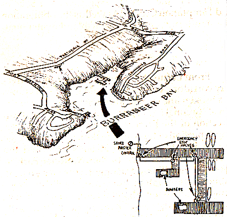 |
Dolans Bay Marina's proprietor is proud of the bay's petite dimensions, especially the below-decks statistic of twenty to thirty feet depth of water not far from the head of the bay where the creek discharges. The statistic makes the twice sheltered, bay-inside-a-bay location, a natural boat harbour, and it's in the marina's commercial interest that it stays that way.
Proprietor Harry Standen also feels it's in his own interest to keep the water quality of Port Hacking in as fine a condition as possible. Because of this, Standen says, Dolans Bay Marina is the first in Sydney to have a multi-valved fuel delivery system designed to close down the available fuel supply at any one of four separate pipe locations along the marina should an emergency occur.
The marina's in-house designed emergency system features a master switch to shut its petrol line down at the storage tanks up at street level, as well as four separate hand operated valves along the fuel distribution pipe's length. These are located under the marina's deck timbers.
The jetty bowsers sit on special stainless steel driptrays,- these being connected by rubber hoses to small overflow containers attached under the marina's decking. Standen says Dolan's Bay was the first marina in Sydney to be equipped for fuel leakages and spills in this manner, adding that he'd like to see the oysters that encrust the marina's pylons below high water mark remain as the marina's perpetual tenants.
Boat Collisions and Consequences
George Harrison
As well as the risk of a traditional scaled oil spill from a bulk carrier moored off Bate Bay, the EPA has also recognised the dangers of spills from sources within the Port.
In Port Hacking there are five marinas with storage facilities for diesel and petrol, these varying in capacity from 5,000 to 13,000 litres of fuel. The EPA considers the most likely source of a spill to be from a ruptured delivery line or from a vessel refueling.
The other likely event is from a collision in the Port. Given 6 boat ramps and 1057 moorings for recreational vessels, as well as 206 commercial moorings, boating traffic is dense enough to make this a real possibility.
The EPA propose the following scenario: "A collision occurs between a commercial vessel and a large pleasure craft at the mouth of Gunnamatta Bay. It is a summer morning with a 20 kph southerly wind and an incoming tide (2 kph), and a substantial amount of diesel oil is released. Within one hour a substantial area of the bay will be affected with oil reaching the head of the bay."
This example is pertinent considering the recurrent proposals to introduce a catamaran service from Sydney to Port Hacking. According to the EPA little can be done to trap an oil spill in Port Hacking, the best remedy seems to be to take all possible steps to prevent one happening. Not Ours!
Many people aware of the Port Hacking Portection Society's consistent effort over the years to put a model of community management for Port Hacking onto the local planning agenda have mistaken the efforts of a separate environmental organisation, the National Parks Association, to have a Marine National Park established in Port Hacking, as the work of the Society.
Community reactions occasioned by the Leader article (9.9.93) announcing that a ban on recreational fishing was a part of this proposal, brought many incorrectly addressed accusations and criticisms to the Port Hacking Protection Society.
That said, the Society also understands that the article that occasioned this response was based on misleading reporting. The Port Hacking Protection Society understands that the National Parks Association's "Curracorang Marine National Park" proposal does not advocate an outright ban on recreational fishing in Port Hacking as was headlined. Take Away the Sand
A page from the Port Hacking Management Plan |
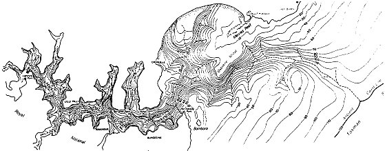

 |
The Donohoe's New Picket Fence
A Distressing Development Down Helensburgh way they're still building Berlin walls. The Telegraph Mirror of November 1 carried an emotive photo story about a couple, who, after 11 years of residence in their Helensburgh suburban home, have had their road frontage and entrance barb wired off from them by a neighbour who claims the street is his.
The two metre fence prevents trespass only on that part of the street outside the quarter acre block of Jim and Jenny Donohoe, stalwarts in a ten year long campaign in the headwaters of the Hacking River catchment to confirm the urban sprawl of Helensburgh. It was put there by their neighbour, Mr Bob Hogarth, who has a 2000 hectare holding next door.
Mr Hogarth's claim is based on the interesting but unclear history of a public road dedicated in an 1895 subdivision. Though the road has been built, sealed and maintained by Wollongong Council for many years, Mr Hogarth maintains he owns it, and has informed the Donohoes in writing that they were trespassing on his property every time they entered or left their home.
Mr Hogarth is presently suing the Donohoes for their role as lead figures in the Helensburgh District Protection Society's long and successful effort to have Wollongong Council recognise the environmental importance of the Royal National Park's headwaters by zoning against further urban development in the upper Hacking catchment. The Donohoes are being sued "for conspiracy" to "damage or destroy the financial and commercial interests" of Mr Hogarth's company, Lady Carrington Estates.
Mr Hogarth denies his fencing has anything to do with motives of a purposefully intimidatory nature: "It was built across the road to prevent people damaging the property" he told the Tele Mirror on November 1 adding in the Illawarra Mercury on the same day that he thought conservationists would support any measures aimed at reducing the risks of fire and rubbish dumping in the area.
In the week after the fence's erection, the Donohoes gained access to their property via an 18 inch squeeze through a side fence.
"There's a gate with a padlock on it inthe middle of the fence, so we don't have access to garbage or water services or milk delivery..." Mrs Donohoe said.
"It's very intimidating, but we won't be intimidated"
Post Script
At the time of this edition went to print, (about a week after the above incident), the State Government's task of officially gazetting Wollongogn Council's Environment protection (7D) rezoning was still on Planning Minister Robert Webster's desk, (where it had beensince April 23 this year when Wollongon Council confirmed its decision), awaiting long overdue action, (as did the previous official form of State certification required in this saga - the Planning Department's approval to Council to exhibit the re-zoning intention in the first place.) The normal time required to gazette such a re-zoning is 6 to 8 weeks.
Also by the time this was published, Mr Hogarth had removed the padlocked gate on the Donohoe's unexpected new fence, and Wollongong Council was pursuing moves aimed to clarify and confirm the Council's ownership of the road under common law. The Importance of Incoporation
By Bob Warren
There are dangers in carrying on an undertaking as an unincorporated association which are of particular concern to those who are office bearers. As an unincorporated association has no separate legal identity it cannot sue or be sued. Apart from the inconvenience of having to vest property in Trustees, those entering contracts on behalf of unincorporated associations are personally liable on those contracts. In normal circumstances Association members have agreed to be liable for their subscription only, but this limitation does not apply to those members of the Committee or office bearers who run the Association's business. Outsiders dealing with an unincorporated association (for example;- grant giving bodies) may also require incorporation.
The primary effect of incorporation is that from the date of incorporation the persons who are menbers of the unincorporated association become an incorporated association and are bound by the rules of the association as if the rules had been signed and sealed by each member. In addition, the incorporated associaton:-
- is capable of performing all the functions of a body corporate
- is capable of suing and being sued
- has perpetual succession
- has the power to acquire, hold and dispose of property
Upon incorporation the liability of the members and officers of the Association is limited. A member or officer, merely by holding that position, is not liable for the debts, liabilities or costs of winding up the Association. If the contractual obligations of the incorporated association are not met, the persons who contracted on behalf of the Association are not automatically liable for the debt incurred. These comments apply to circumstances where, for example, a Court action was brought against the Association for injuries suffered by a visitor to the Association's premises, or at a function conducted by the Association. Before incorporation all the members of the association may be personally liable for any damages or compensation awarded subject to any insurance cover that may have been taken out. |
| top of page |
|