|
 |
August 1997 |
|
Editorial |
 |
The Facts, the Anecdotes, the Problems, and the Cure
We are lucky in Port Hacking. A lot of caring people are working hard to keep the waters clean. Much of the work being done is to stop pollution getting into the Port, and to fix up the results of past mistakes. But there is a lot more to be done.
This Protectorate is about pollution in the Hacking catchment, what is being done about it, and what more needs to be done to protect our estuary and river.
Surveys have shown that one of the major concerns of residents and visitors alike is the quality of the Hacking waters. The Hacking River Catchment Management Committee (HRCMC) compiled a Pollution Source Inventory.
Solving the pollution problem in Port Hacking requires the cooperation and commitment of many Government and non-government groups. Many activities are being proposed or investigated, to improve the Hacking water quality. Unfortunately action is often deferred because the various groups are not coordinated. Some problems are not being considered, because there is no mechanism for ensuring that someone takes responsibility for them.
Almost every issue in the Port suffers from a lack of coordination, confusion, and a lack of resources. Environment protection, improved recreational facilities, navigation, foreshore protection, user safety, habitat protection - all are subject to the same jurisdictional problems. There has to be a better way of looking after our Port Hacking! Integrated Management
Here is a partial list of groups concerned with the management of Port Hacking:
-
Sutherland Shire Council
-
NSW Fisheries
-
Waterways Authority
-
Dept of Land and Water Conservation
-
Dept of Minerals and Energy
-
National Parks & Wildlife Service
-
Dept of Sport and Recreation
-
Environment Australia
-
Sydney Water
-
NSW EPA
-
Environment groups such as Sutherland Environment Centre, Port Hacking Protection Society, National Parks Association and the National Trust
-
Precinct Committees, particularly those distributed throughout the foreshore areas of the Port
-
Progress Associations and Chambers' of Commerce
-
Yachting and Boating interest groups
-
Other recreational interest groups
-
Academic and research groups, including the Australian Museum and the universities which conduct studies within the Port
-
Commercial interests including ferry operators, diving schools, marina operators and related businesses
The threats to the sustainable enjoyment of Port Hacking come from incremental damage, like over-harvesting of the foreshores, physical damage to the seagrass beds, increasing pollution, including noise pollution, and the like. Management of incremental damage involves many jurisdictional issues and balancing of diverse interests. A lot of energy is being wasted in jurisdictional negotiation. Little energy is left to do anything useful. A single management authority is needed to overcome these problems. |
Integrated Management - it can be done!
The Port Hacking Protection Society's aim continues to be:
-
to have established a single body with jurisdiction over the whole of the Port and its catchment with the exception of areas under the control of the National Parks and Wildlife Service,
-
which administers the area in a co-ordinated manner, in line with a set of established values and principles, for the proper management of this area,
-
(with) active community representation and involvement.
To provide for the sustainable recreational use of the Port requires:
-
Balancing competing uses of the Port, to protect waterway users from each other, and to protect the interests of those using the foreshores.
-
Preserving the environmental quality of the waterway and its surrounds.
-
Facilitating the recreational use of Port Hacking within the context of the first two challenges
Has integrated management been tried elsewhere?
Yes it has. Effective integrated management arrangements range from management trusts, to placing all powers and resources into the hands of a single authority, overriding the jurisdiction of all other authorities. There are over 27 integrated plans in operation in the UK, and 5 in Scotland. There is a myriad in operation in the USA, including Chesapeake Bay and Galveston Bay and large areas off Hawaii and Miami, all focused on sustainable use of areas which have a mix of commercial and recreational uses and environmental sensitivity.
In Australia, Marine & Estuarine Protected Areas are being developed for sensitive areas. Where commercial and recreational uses require coordinated management, special arrangements have been developed. Port Phillip near Melbourne is one such example, and Maroochy in Queensland is another.
Proposals are under development for Sydney Harbour.
What are the barriers?
The only barrier is the lack of will on the part of those with legal authority to come up with an effective way of integrating the management of Port Hacking. Currently the Hacking River Catchment Management Committee, Sutherland Shire Council's Port Hacking Planning and Advisory Group, the Coastal Councils group, and the Waterways Authority's Waterway Users Group are all claiming to play a coordinating role. It is clear from protracted debates over issues that require urgent solutions, pollution being one of them, that the current system of coordination is not effective. A better solution to integrated management is required with better resourcing from all authorities involved. |
|
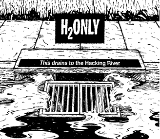
What's Pollution Port Hacking and Its Catchment?
People notice silt, sewer, rubbish, oil and debris when it pollutes the Port. No beach is free of cigarette butts, plastic bottles and bags, and broken glass. Some fishers add fish hooks, tangled fishing line and the stinking remains of bait to the usual beach rubbish. Bays used by boats display oil slicks. Urbanised foreshores show off stormwater overflows with their delta of litter and ooze.
These types of pollution are obvious. But if we really want to understand what's polluting the waterway, we have to add to the list those pollutants we don't see, or don't notice as quickly. These less visible pollutant are: weeds that choke native vegetation; organic chemicals that kill more that they are meant to; heavy metals escaping from the bottoms of boats and foreshores; plant nutrients that come from fertilisers and domesticated animals; and micro-organisms from stormwater runoff, sewage discharges from boats, sewerage treatment plants and houses. |
 |
The Hacking River Catchment Management Committee's (HRCMC) Pollution Source Inventory puts pollutants in the waterway into six categories:
-
Suspended Solids or non-dissolved matter in the water.
Suspended solids can include clay, silt, microscopic organisms and other organic and inorganic matter. They come mostly from development and construction sites in urban areas and from rural areas where land has been degraded by overstocking and where the banks of creeks have been destabilised by hard-hoofed animals accessing water.
Suspended solids pollute water by making it cloudy. Apart from not looking nice, the cloudiness decreases the amount of light penetrating the water and reduces the health and growth of aquatic plants and algae in the water. With reduced availability of aquatic plants and algae, there is less food available for animals relying on the plants. When the solids settle, animals living on the bottom of water courses can be smothered. Also fish can suffer or die from the abrasive action of the solids on gill tissue.
-
Plant nutrients, made up mostly of Ammonia (Am), Phosphorus (P) and Nitrogen (N), encourage plant growth. These nutrients come from animal faeces, stock manure in rural areas and sewer overflows. They are also the major chemicals in fertilisers used on private and public gardens. The nutrients are washed down storm-water drains and into waterways from gardens, sidewalks, parks and rural properties.
Large amounts of nutrients encourage rapid growth of aquatic plants, including algae and weeds along waterways. These can cover the surface of the water, stopping light from penetrating and reducing the exchange of oxygen between the atmosphere and water. Algal blooms floating as rafts on the water surface can also deoxygenate water at night. They absorb oxygen from the water, leading to kills of fish and other animals which depend on oxygenated water. As the dead animals decay, more oxygen is used up and even more animals and plants are effected.
-
Micro-organisms such as Faecal Coliforms (FC), Faecal Streptococci (FS) and Enterococci come into the Port in stormwater runoff which contains soil, decaying matter and sewer/septic overflow and seepage.
Micro-organisms cause nose, throat and skin irritations as well as gastro-intestinal complaints.
-
Heavy metals. Copper (Cu), lead (Pb), zinc (Z), tin, mercury, cadmium, chromium reduce the health and survival of aquatic life. They accumulate in fish and shell fish which may be eaten by other animals, including people, causing them health problems. The metals get into the waterway through urban runoff and boating activities. Runoff is contaminated by heavy metals from galvanised roofs, fuel combustion, cadmium and zinc from tyres, and copper and chromium from brake linings. Industry discharges, sewage effluent and anti-fouling paints used on boats also add to the load of heavy metals in waterways.
Heavy metals will settle on the bottom of waterways where they have potential to do less damage, but turbulence from motor boating and dredging re-suspends them. Heavy metals may also be taken up by aquatic plants which are ingested by fish and invertibrates.
-
Organic chemicals are what make up herbicides and pesticides used in domestic gardens and on rural properties. They effect the health and survival of animals and plants. The chemicals make their way into the waterway through runoff. Herbicides have been implicated in causing the reduction in frog populations around the world.
As well, overuse of herbicides increases the problem of weed infestations rather than reducing them. Pesticides have been responsible for killing aquatic life in several creeks in the Shire, including an incident in Dents Creek last year.
-
Weeds: A weed is a plant out of place. In the catchment, weeds are generally exotic plants that replace native vegetation. They come from dumped garden refuse and runoff from urban areas containing seeds and cuttings. Invasion of weeds along waterways into the Royal National Park from the upper catchment has been significant. Remnant bushland in urban areas, however, is also affected.
|
Deadly rubbish
Litter found on the beaches and in the sea comes from ships, recreational fishing and boating, commercial fishing activities or land-based sources such as beach users, stormwater outfalls and windblown litter.
Seventy percent of debris on beaches and waters along the eastern coast of Australia is found of land-based sources. This debris includes plastic bags, confectionery wrappers, cigarette butts and plastic fragments. Balloons have been found entwined within the chest and abdominal cavities of dead birds. They probably caused the birds' deaths. Turtles have starved to death after eating plastic bags they mistake for their usual prey, jellyfish. Sea birds eat fragments of plastic, apparently mistaking them for fish eggs and suffer the toxic effects of that plastic in their guts. Micro-organisms could travel on rafts of drifting plastics and bottles to new shores where they become a nuisance, sometimes a deadly nuisance.
Rubbish can also cause harm to human activities. Debris can damage propeller shafts and block engine cooling inlets. Ropes, fishing line and netting can snag on submerged structures and threaten the safety of scuba and skin divers. Syringes, broken glass, rusted cans and containers of toxic substances on beaches are a danger to beach users. |
|
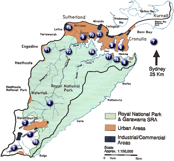
Pollution in Port Hacking - Where is it Coming From?
To find out which areas were severely polluted, the Hacking River Catchment Management Committee (HRCMC) gathered both anecdotal and written information for their Pollution Source Inventory.
The accompanying table shows where testing has been carried out in the Hacking catchment and the types of pollutants that have been found. Only sites where more than the maximum level as per ANZECC guidelines is far exceeded are shown in the table. The Pollution Source Inventory gives more details about other sites tested. Not all areas have been tested for all pollutant types. For example there have been few tests for the presence of heavy metals but many tests for the presence of micro-organisms and plant nutrients. Also some areas, such as Bundeena, Maianbar, Helensburgh and Cronulla have had many tests done. Other areas have had no tests done so no one knows what pollutants may linger there. |
 |
Water Quality in the Hacking River Catchment
Source: Pollution Source Inventory (HRCMC) |
Sites where testing was carried out |
Pollution type occurring in
the site above recommended levels* |
 Camp Gully Camp Gully |
- suspended solids |
| - plant nutrients (P, Am) |
| - micro-organisms |
| - weeds |
|
 Kelly's Creek Kelly's Creek |
- micro-organisms |
| - plant nutrients (Am, P) |
|
 Wilson's Creek Wilson's Creek |
- micro-organisms |
| - plant nutrients (Am) |
|
 Waterfall Causeway Waterfall Causeway |
- micro-organisms |
| - plant nutrients (Am) |
|
 Dolans Bay Dolans Bay |
- suspended solids |
| - micro-organisms |
| - plant nutrients (N, P) |
| - heavy metals (Z, Cu) |
|
 Head of Gunnamatta Bay Head of Gunnamatta Bay |
- suspended solids |
| - plant nutrients (Am) |
| - micro-organisms |
| - heavy metals (Cu) |
|
 Bate Bay Bate Bay |
- suspended solids |
| - micro-organisms |
| - plant nutrients (Am, N, P) |
| - heavy metals (Z) |
|
 Bundeena Creek Bundeena Creek |
- suspended solids |
| - micro-organisms |
| - plant nutrients (N, Am, P) |
| - heavy metals (Z) |
|
 North West Arm North West Arm |
- suspended solids |
| - micro-organisms |
| - plant nutrients (Am) |
| - heavy metals (Z, Cu) |
|
 Gymea Bay Gymea Bay |
- suspended solids |
| - micro-organisms |
| - plant nutrients (Am) |
| - heavy metals (Z, Cu) |
|
 Engadine Creek Engadine Creek |
- suspended solids |
| - micro-organisms |
| - plant nutrients (P) |
| - heavy metals (Z, Ph) |
|
 Audley Audley |
- micro-organisms |
| - plant nutrients (Am) |
|
 Head of Yowie Bay Head of Yowie Bay |
- micro-organisms |
| - plant nutrients (Am) |
|
 Deer Park Deer Park |
- micro-organisms |
| - plant nutrients (Am) |
|
 Cabbage Tree Creek Cabbage Tree Creek |
- micro-organisms |
| - plant nutrients (N, Am, Pb) |
|
 Savilles Creek - upper reaches Savilles Creek - upper reaches |
- micro-organisms |
|
 Fisherman's Bay Fisherman's Bay |
- micro-organisms |
| - plant nutrients (N, Am, Pb) |
|
 Gardners Creek Gardners Creek |
- plant nutrients (Am, Pb) |
|
*Only sites where more than the maximum level as per ANZECC guidelines is far exceeded are reported. The data used to compile the Pollution Source Inventory may be ten years old. In some cases significant works have been undertaken or are in the progress to reduce the impact of pollution sources - e.g. new spetic systems at Audley, wetland construction at Engadine, gross pollutant traps in the Sutherland Shire and upgrade of the Cronulla Sewage Treatment Plant. Runoff
Most pollutants find their way into Port Hacking and its tributaries through water runoff from rain, garden hoses, etc. Studies of water in drains in the Hacking catchment shows that it can contain plant nutrients, suspended solids, micro-organisms, litter, pesticides, herbicides, trace metals and oils, and seeds from plants including those from exotic and noxious plants. |
 |
Stormwater draining into the heads of bays is a bigger problem than that draining into the main section of the Port. Pollution in the bays takes longer to dilute because bay water takes longer to mix with fresh ocean water than the main channels of the Port. Polluted runoff into bays is also a problem because bays are heavily used for recreation.
Sutherland Shire Council is currently mapping stormwater runoff channels. Their studies show that runoff containing high loads of suspended solids drain into Gunnamatta Bay, North West Arm and Gymea Bay. The sediment probably comes from construction sites, soil from parks and gardens and stream bank erosion. The runoff into Yowie Bay, Gymea Bay and Gunnamatta Bay contains high levels of Faecal Coliform, probably from sewer overflows and leaks. Yowie Bay has high levels of lead which may be coming from runoff from President Avenue. Another element of runoff, particularly from the commercial areas in the catchment, is litter. Ewey Creek, which drains Miranda Shopping Centre, has a high level of litter, mainly from fast food outlets.
Plastics and polystyrene containers are the worst litter problems because they often miss the trash rack and are hard to catch because they float. Engadine Avenue has the same problems with litter from fast food outlets. In the upper catchment,the local Landcare group, together with local schools and community groups, are monitoring runoff from Helensburgh into Creeks around the township. The results of the study should give a clearer idea of the effect of water runoff from the township. The prolific weed growth around stormwater pipes in Helensburgh indicates they carry a high nutrient load. There is also some evidence that weeds are spreading into the Royal National Park from Helensburgh.
Kellys Creek, in the upper catchment suffers from runoff from the nearby F6 Freeway. There are no trash racks or barriers to collect rubbish from the F6. This is a problem that should be addressed by the RTA who have jurisdiction of the area.
Natural runoff is, theoretically, not polluted. The Hacking catchment is lucky to have 60% of its area covered by bushland. However, this bushland is also heavily used by recreators some of whom litter, leave excreta and use vehicles in the area. In addition, runoff in natural areas is also more polluted than it should be because of the damage caused by feral animals. The most damaging animal is the pig which de-vegetates large areas in search of food and causes pollution to enter the waterway. Deer, goats and rabbits also damage the soil structure and vegetation in the National Park leading to reduced soil stability. |
Runoff that kills
In the Hacking Catchment, runoff can be dangerous. It has killed eels, perhaps platypus, and made people sick. Last year, pesticides were dumped into Dents Creek, resulting in a kill of eels in the creek and an expensive clean-up operation. A spill of the acid, phenol, also occurred a few years ago at the Prince's Highway at Engadine, washing into Kangaroo Creek. Some people suggest that an acid spill from a ruptured tanker at the twin bridges in Helensburgh caused the demise of platypus in the Royal National Park. Up to the time of the spill, surveys had shown a healthy population of platypus in the Park. After the accident, platypus disappeared from the Royal.
A significant user of herbicides in the Sutherland Shire is Sutherland Shire Council. After several approaches to PHPS by concerned members of the public about apparently careless use of herbicides by Council staff, PHPS wrote to Council a month ago asking for details of their policy on herbicide use. Among other questions we asked:
-
Does Sutherland Shire Council use trained herbicide operators and are only trained operators allowed to use herbicides?
-
How is herbicide use monitored and is there a program that controls the use of herbicides?
-
Are alternatives to herbicide use regularly assessed and implemented where appropriate?
We will publish the answers to these questions once we have a reply. |
|
Councils and Government Authorities attempt to reduce pollutants in stormwater runoff in a number of ways. The acitivities include educating the public to be careful that pollutants don't make their way into stormwater drains. They tell the public to wash vehicles on grassed areas rather than in driveways or on streets, not dump rubbish, not leave faecal matter from pets on streets and footpaths and sweep up wastes rather than hosing them into storm water drains. Councils also sweep streets on a regular basis to reduce the pollutant load. In the Sutherland Shire, roads and footpaths of commercial areas are swept on a daily basis. Most other curbed and guttered roads are generally swept on a monthly basis.
Sutherland Shire Council has also installed pollution control devices in the Shire and plans to install more. Currently it has one CDS (Continuous Deflective Separation) unit and two detention basins installed in Caringbah, and detention basins in Menai and Woolooware. The Council, in conjunction with NPWS has constructed a wetland in Engadine. It also maintains a wetland in Caringbah. Further, the Council has put in place Gross Pollutant Traps (GPT) throughout the Shire suburbs. There is a GPT in Yowie Bay, four in Cronulla and a further one planned, two in Engadine, and two in Miranda. Council also has plans for GPTs for Menai and Sutherland. In addition, Council has two trash racks constructed in Woolooware, one in Gymea Bay, one in Burraneer, one in Miranda and a further one planned for Miranda.
The amount of rubbish GPTs trap is high. Council recently cleared 16 tonnes of rubbish that would have flowed into Gunnamatta Bay from a GPT in Cronulla The Source of Sediment in the Port
Most of the bays on the northern side of Port Hacking are affected by land-based sediment.
A study in Yowie Bay found that 0.5 to 1 metre of sediment on the floor of the Bay resulted from soil washed down when the area was cleared for rural development in the 1850s and, more significantly, housing development in the 1950s and 60s. Gunnamatta Bay and Gymea Bay have obvious signs of silting from land-based sediment. In the Upper catchment, Wilsons Creek, Camp Creek, Engadine Creek, Kellys Creek and gullies draining into these creeks show evidence of above natural levels of sediment deposits.
Sediment comes into the Port from building sites, from the colliery near Helensburgh, from rural lands around Helensburgh and Otford, and from sand and gravel site extractions. In fact, from any area that has had vegetation disturbed or removed, such as parks and gardens and stockpiles of dirt. |
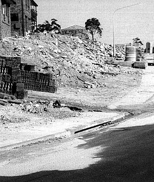 |
Last year, Sutherland Shire Council carried out a compliance study on building sites in the Shire. Of the 27 sites inspected, 13 had no on-site sediment and erosion controls, 9 had some form of erosion control but the controls were ineffective. Only 5 sites had good erosion and sediment controls. Five to ten tonnes of sediment can wash into waterways from a single building site in a storm event.
Builders can be fined up to $120,000 for failing to put in sediment controls. Sutherland Shire Council officers and EPA officers can give "on the spot" fines of up $600 for failure to comply. In fact, recently, Council did impose a large fine for inappropriate sediment control on a building site.
Sutherland Shire Council, together with the Hacking River Catchment Management Committee (HRCMC), has developed a pamphlet that contains information of how to store stockpiles, and where to place hay bales and Geotextile material fencing to filter sediment for stormwater runoff. The pamphlet also contains general information on how to plan construction to reduce soil loss by minimising the time that the top soil remains exposed. Wollongong City Council requires soil and erosion control plans to be submitted with all building applications.
Apart from building sites, the Metropolitan Colliery at the end of Park Street, Helensburgh has been an ongoing a source of sediment into the catchment. The Colliery is an underground coal mine. It is situated next to the lower section of Camp Gully where it has a stockpile of coal wash. Sediment dams and sand filter ponds capture storm water runoff and water used to wash coal. However, in heavy storms, the stockpile has slumped in the past, depositing large amounts of sediment in the nearby streams. The Colliery is looking towards removing its stockpile to less sensitive areas, but this has not yet occurred.
The Colliery also contributes to sediment in the catchment by providing coal wash for use as landfill, as a surface material for roads and tracks and to develop sporting fields. From an environmental point of view, coal wash is not a good surface material. It erodes easily and is not easy to revegetate. Most streams around Helensburgh are significantly effected by coal wash.
Sand and gravel extraction sites in the upper catchment are also sources of sediment. There are two major sites in Kellys Creek and Gills Gully. These sites have been cleared of vegetation. They have runoff control ponds designed to capture runoff and allow for sediment to settle but the ponds are probably inadequate to cope with high volumes of runoff during heavy rainfall. The Soil Conservation Service recommended that rehabilitation work be carried out but this work does not appear to be happening.
Also in the upper catchment are lands used for livestock purposes, predominantly for horses but also cattle and pigs. The rural lands are generally overstocked and have low vegetation cover. In addition, the hard hooves of horses, cattle and pigs damage the soil structure and destabilise stream banks when they access the streams for water. The damaged and unvegetated soil rapidly washes into streams in wet weather, often down trails made by horse riders. Weeds!
Noxious Weeds in NSW are spreading!
This was the conclusion of the NSW Department of Agriculture in July 1996. The Department has appointed an Officer specifically to enforce more action on getting rid of noxious weeds in the Sydney area.
Noxious weeds are plants which are considered to be a threat to human and animal health, agricultural production, native landscapes or natural resources such as water supplies. They are hard to eradicate, spread rapidly and may have toxic or harmful properties.
Sutherland Shire Council has had a rather haphazard method of dealing with noxious weeds. From 1991 to 1993 it had no specific noxious weed eradication program except for that implemented by two weed controllers on herbicide units. Since 1993 it has relied on bush regenerators and a volunteer contingent recruited under the Bushcare Programme. Consequently, eradication of weeds is mostly restricted to bushland reserves where bushcare volunteers and regenerators work.
Obviously these strategies have not been good enough. For example, in 1988, there were only 5 known sites of Asthma Weed (Parietaria judaica) in the Sutherland Shire. Asthma Weed causes asthma, conjunctivitis and rhinitis in people. In 1993, there were over 40 sites. At present, a new site is observed almost weekly. Another example is the spread of Pampas Grass (Cortaderia selloana). Kurnell Peninsula is heavily infected. Pampas Grass chokes out natural bushland. The Pampas Grass on crown and Council land at Heathcote, Waterfall, Engadine and Loftus is severely degrading those public lands and infecting Royal and Heathcote National Parks. Almost every creek and bushland area in the Shire is infected by another noxious weed, Lantana (Lantana camara). In spite of the obvious signs of weeds spreading, Sutherland Shire Council, appears to be slow in implementing a strategy of weed control in the Shire. |
|
National Parks and Wildlife Service are stepping up their program to reduce weeds invading national parks in the catchment. They are particularly targeting, cestrum parqui, a straggling perennial shrub poisonous to livestock and humans, and Lantana along Jibbon Beach and watercourses in the Hacking Catchment. They are also including eradication of pampas grass, prickly pear, inkweed (Phytolacca octandra), castor oil plant (Ricinus communis), moth vine (Aruajia hortorum), small leaved privet (Ligustrum sinense) and species of Aloe.
The Helensburgh and District Landcare Group has been busy eradicating another noxious weed, gorse weed (Ulex europaeus) from the upper catchment. Gorse Weed is a category two noxious weed, requiring removal within 30 days of notification on private property or a $10,000 fine can apply. Last year the Group found up to 70 plants on some properties. They helped landowners remove the weeds and are currently carrying out follow up work. An infestation was noticed earlier this year near the junction of the Princes Highway and Lawrence Hargreave Drive, and spreading down Gills Creek. Together with NPWS, they have been undertaking an eradication program. The group has also targeted Pampas Grass and Bitou Bush and aims to have these eradicated within five years. |
|
You can make a difference!
To help stop weeds overrunning your bushland, parks and gardens:
-
remove plants from your garden that become weeds and replace them with local native species
-
don't dump garden waste in the bush
-
join a bushcare group and lend a few hours of your time each month
Contact: Bushcare Sutherland Shire Council 9710 0192 |
|
Pollution from Garbage
The Helensburgh garbage depot located at the head of Garbage Tip Creek is the only waste disposal site operating in the Hacking catchment. An industrial landfill site at Kurnell may also have an impact within the Port through leaching into the underground water table. However, we have no information whether this is the case.
The Helensburgh depot accepts mixed wastes from Wollongong suburbs above Coalcliff and uses coal waste from the Metropolitan Colliery as cover material. Next to the garbage depot is a Sanitary Depot which accepted sewage effluent and night soil for 100 years before closing in 1991. Surface drainage water, rainfall and groundwater move through solid waste landfill, dissolve and suspend material and microbial wastes and deposit the leachate into nearby waterways. At Helensburgh, leachate is being collected and disposed via the sewer system. The EPA recently checked the water in the water course below the waste disposal site and found it was high in nitrogen and micro-organisms in wet weather but not a problem in dry weather. Wollongong City Council is currently looking at the extent of the impact of the disposal site on the area and on different options for reducing its impact. A Cooperative Clean Up
The Helensburgh and District landcare Group has been instrumental in the identification and cleanup of an illegal dump site on Cawley Road near the entrance to the Garrawarra State Recreation Park in the upper Hacking Catchment.
On Saturday, February 1, 1997, Allan House from the Helensburgh and District landcare Group visited the Cawley Road dump site and found extensive commercial dumping of building site refuse and hazardous chemicals. This included 17 full (4 gallon) drums of liquid waste, car batteries and old tyres. An examination of the area with officers from Wollongong Council found that one of the drums had split and that every plant and shrub within the surrounding brown-stained area was dead. The Environmental Protection Agency was notified and the waste removed for analysis. Contents of the drums proved to be cooking oil and highly flammable printers' solvent, which the Bush Fire Brigade regards as likely to explode in the event of bushfire.
In early April a combined meeting was held to discuss the Cawley Road issue. Chaired by Wollongong City Council it included representatives from Transgrid (the providers and servicers of overhead electricity cables), National Parks and Wildlife Service, Rail Service Authority, Land and Water Conservation and the Helensburgh and District Landcare Group.
The meeting recognised the need to restrict access to the road if the problem of illegal dumping was to be solved. Transgrid agreed to install a solid steel gate if the road could be permanently closed. Both Transgrid and the Rail Services Authority agreed to donate heavy machinery for a day, with Wollongong Council investigating possibilities for further donations of machinery. Land and Water Conservation agreed to pay costs of fuel for the machinery, and for tipping costs. Wollongong Council agreed to erect signs to the effect that the road was closed due to illegal dumping.
The Helensburgh and District Landcare Group volunteered to organise a preliminary cleanup over six weekends before heavy machinery was called in, volunteered by . Loose material was bagged and dragged from the surrounding bush and side tracks to the main road ready for removal by heavy machinery, which had been volunteered by various authorities. |
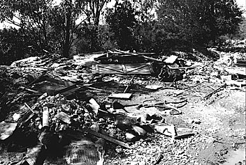 |
A group of 35 volunteers, organised by the Helensburgh and District Landcare Group, worked to clean up the area over the course of six weekends. They bagged and dragged loose material from the surrounding bush and side tracks. Seven large trailer loads of metal was removed for recycling. Building refuse has been gathered on a 100 metre stretch of the road, but, to the frustration of the volunteers, has remained unmoved while a decision is being made whether Cawley Road should be closed. The Department of Land and Water Conservation has placed a public notice seeking objections to a closure of the road. Until submissions have been received and reviewed none of the other authorities will move in the heavy machinery needed to complete the cleanup.
The volunteers are concerned that their work will have been wasted unless this situation is resolved. Sewage in the Port
Sewage comes into the waters of the Hacking catchment from: the Cronulla Sewerage Treatment Plant; from sewer overflows, surcharge and leaks; septic systems, and discharges from boats.
Sewage can contain micro-organisms, visible pollutants such as solids and grease, chemicals, heavy metals and industry wastes. By its very nature it is also high in plant nutrients (P and N).
A major source of pollution in Bate Bay is the Cronulla sewerage treatment plant. The plant treats the sewage of approximately 190,000 people. It removes solids and much suspended material from the effluent (primary treatment) and discharges the primary treated effluent into Bate Bay from Potters Point. In dry weather, the plant discharges about 50 megalitres of effluent per day.
Generally, the effluent from the discharge point moves offshore effecting only aquatic life. There are records that show aquatic life is badly effected by the effluent up to about 150 meters away from the Potters Point outfall. When winds are from the south and wave action is high, effluent moves into Bate Bay and onto the beaches making them unsafe for recreation.
Sydney Water, which is in charge of the Sewage Treatment Plant, has been improving the operations of the Plant. They plan to upgrade the plant in the next few years so that effluent discharged will be tertiary treated. Tertiary treated effluent has had sediment, many nutrients and chemicals removed and is partially disinfected. Sydney Water has also been trying to reduce the effect of wet weather on the sewerage system.
In theory, wet weather should not effect the sewerage system. Unfortunately, water seeps in through improperly closed manholes, cracks or open joints in pipes or faulty or illegal plumbing connecting roof drainage to the sewer system. Wet weather conditions can increase effluent discharges threefold to about 150 megalitres per day.
Throughout the sewerage system, sewer overflows have been constructed to relieve pressure in sewer pipes that may build up as a result of blockages, pump failure or increased flows such as occurs in wet weather. There are approximately 82 designated overflow points in the Hacking catchment. The overflows are mostly located near natural waterways or stormwater drains so that the overflowing effluent can quickly drain away. These overflows, however, pollute Port Hacking and many of the waterways in the northern part of the catchment.
During wet weather the major overflow problems tend to occur in the Caringbah area and in the vicinity of Gymea Bay and Yowie Bay. Sewerage leaks into Gunnamatta Bay seem to be a problem in both wet and dry weather. In 1992, the Water Board estimated that about 178,000 m3 of effluent enters Port Hacking each year and' about 15,100 m3 of effluent enters the river above Audley Weir each year.
Sydney Water, which is responsible for maintaining the sewer system, had allocated $26,000 for checking connections to the sewer system at Cronulla and has completed the check. It was unable to identify a site or source for the pollution. They speculate that it may be caused by a sewer pipe connected to a stormwater drain.
Unfortunately, the areas most impacted by sewer overflows in Port Hacking are bays and beaches extensively used for recreation purposes. Generally when there is an overflow, it stays in the effected area for several days because the receiving waters are slow to dilute the sewage.
The same problems associated with sewer overflows affect areas that rely on non-reticulated sewer systems such as septic tanks and pumpout facilities. Currently the townships of Bundeena, Maianbar, Otford, Stanwell Tops and Boat Harbour as well as approximately 10% of houses in Helensburgh rely on non-reticulated sewage systems. Sydney Water and Sutherland Shire Council is currently working with these communities to address the problems related to septic systems. Boat Activities in the Port |
 |
Great fun, blissful relaxation, escape from pressure, a hobby, outdoor exercise, family enjoyment, effluent, litter, old paint and marine organisms scraped and washed off boats, slipways, boat ramps, moorings, damage to the seabed, and noise are the mixed blessings bestowed by boating activity on Port Hacking, its residents and users.
Boats are an integral part of Port Hacking. Many people come to the waterway especially to enjoy their boats, large and small. Even for those who don't own boats, watching the boats on the Port can be a pleasure. Most people who use the waterway and care for it would like to see Port Hacking a safe and pleasurable place for boating activities as well as other activities.
In Port Hacking most of the bays on the northern side of the Port are used for mooring. Only Fishermans Bay, Bundeena Bay and Simpsons Bay on the southern side have designated mooring. During public holidays and weekends popular overnight anchoring locations include off Jibbon beach and in the southern end of South West Arm.
Tests of waters in which boats are moored and worked on usually reveal higher levels of pollutants than where they are not moored. These include grease, Faecal Coliforms and heavy metals. In addition, areas associated with boating activities are often littered with plastic bags, containers and beer cans, and a scum of fuel and oil. Around most slipways, there is an accumulation of tin, copper and lead in the sediment resulting from paint scraped from boats. When the sediments are disturbed through dredging or power boat activities, the metals are resuspended increasing their potential to cause harm to human and aquatic life.
Sutherland Shire Council and other authorities are currently discussing ways of reducing pollution caused by boating activities. The Port Hacking Planning and Advisory Committee have been working for some time on an educational brochure for boaties. They are also working to establish public pumpout facilities for sewage and encourage the use of pumpout facilities.
As boating activity in the Port becomes more intense, so too will the adverse impacts. The boating community, more than any other group, should have a powerful incentive to eliminate the adverse side effects of their recreation. |
Pumpout facilities for boats
It has been illegal to discharge sewage wastes into Port Hacking since 1988. However policing of discharges does not generally occur in the Port. At present there are three private pumpout facilities in Port Hacking. They are located at Dolans Bay, Burraneer Bay and Gunnamatta Bay. There are no public pumpout facilities in the Port, although Sutherland Shire Council is currently looking for a suitable site to establish such a facility. In 1995, Sutherland Shire Council identified high levels of Faecal Coliform in Gymea Bay that were not associated with urban runoff. They concluded that boat discharges were the most likely source of this contamination. Boat discharges input nutrients, detergents, oils and grease as well as faecal related pathogens into the Port. Beer cans, plastic bags and containers originating from boats also litter areas frequented by boats. |
|
Dear Editor (by Phone)
(Editor's note: This is not a word for word restatement of the conversation but hopefully captures the idea.)
You recently refered to the installation of gross pollutant traps (Protectorate issue 13), and to the problems of sediment at the heads of bays. Perhaps there is an alternative view on the causes of the problems, and on the best way of solving them.
Concrete stormwater drains have been installed throughout the Shire. They are designed to maximise the flow of water away from the streets, eventually into the Hacking.
It takes just a little thought to realise that maximising the volume and speed of stormwater will also maximise its capacity to carry sediment and rubbish into the Hacking. Perhaps there is an alternative way of designing stormwater drains that will reduce the amount of sediment that they carry into the Port. What about including ridges or pockets in the stormwater channels, and regularly cleaning these out? Or perhaps distributing smaller trash racks and sediment collectors within the stormwater drain system? We may be able to solve many of the problems before the sediment and waste are transfered into the Port. Ron Mahler, Caringbah
Comment: The best ideas are often simple, and increasingly it is being recognised that it is better to fix problems at their source, rather than to correct them later on. We will bring this to the attention of Council. Any other creative suggestions to solving problems, or improving the amenity of the Port?
Dear Editor (by Letter)
Dear Editor,
There is no doubt that a future significant pollution source in the Port Hacking Catchment will come from the Holsworthy Airport if the Federal Government gets its way.
The construction of Holsworthy Airport would be the biggest civil infrastructure project in Australia's history. It would require millions of tonnes of fill to level gorges. It would require the destruction of much pristine bushland. Vast areas would be covered by hard surfaces for runways, roadworks and buildings, increasing speed of runoff in the area.
Much of the direct impact of Holsworthy would be on the George's River Catchment. The Woronora Water Supply for Sydney would be severely effected, as Paul Broad, the head of Sydney Water agrees (Sun Herald, 1.6.97). Woronora Dam supplies water for 200,000 residents in southern Sydney. The bush, which has always played an important part in filtering and purifying Sydney water, would be devastated if the airport goes ahead. Add to this devastation the pollutants that would inevitably come from a huge infrastructure serving millions of people every year.
There would also be a significant impact on Port Hacking. The infrastructure to serve the airport would without doubt spill into the Hacking catchment. Visitor rates to the Royal National Park would increase significantly. Traffic congestion on roads throughout the catchment would increase significantly. Pressure would increase to service tourists. As well, spills of fuel and increasing aircraft noise would occur in the Hacking Catchment. Destruction of bush in Holsworthy would also reduce significant habitats for already beleagured native animals. Studies have shown that animals found in the National Park roam from Holsworthy into the Royal and Heathcote National Parks. Neil de Nett, Bundeena
Dear Editor,
The pumping of nippers on the Maianbar flats has caused Fisherman's Bay to become an oozing smelly mud bay, according to the locals who remember Fisherman's Bay with white sand and lots of fish.
Now the nippers are becoming depleted through over-pumping, the action has moved into our channel which flows behind the Deeban Spit beach and into "The Basin" which was once called the Fish Hatchery.
Where there was once white sand, it is now becoming dark brown. This is a children and adults wonderful swimming area and many locals say we have lost our lovely channel. The channel has become so bad it looks like a dirty moon crater at low tide and I believe the fault is due to the licensed fisherman whom, in its wisdom, the Fisheries Department have seen fit to give a licence to catch nippers!!
Now if they could keep him out of our channel to save it for a swimming area it would be wonderful. I would have a sign forbidding pumping in the channel. As it is used by the Bonnie Vale campers during holidays, I'm sure the National Parks would lend support. G King, Maianbar
Comment: We have made enquiries once before to Fisheries about the wisdom of allowing nippers to be harvested in the area. We were assured that the practice would do no harm. We shall enquire yet again.
Myth or Magic? Is a reticulated sewerage system the best way to make the environment safe?
Samples of water from stormwater drains and sea outlets from the northern, heavily urbanised catchment of Port Hacking and samples of waters from Bundeena/Maianbar areas both show levels of Faecal Coliforms far in excess of ANZECC guidelines in both wet and dry weather.
In both cases, the presence of high Faecal Coliform levels is attributed to sewage runoff. The northern catchment is serviced by a reticulated sewerage treatment system. Bundeena/Maianbar are not.
Attempts at finding the source of sewage runoff into the stormwater system in the northern suburbs are underway but quick solutions are not likely. The sewerage system is in need of significant overhaul, especially to cope with the projected increase of population in the Sutherland Shire area. There have been no promises of money to carry out this urgent work.
In Bundeena/Maianbar area, the Government has allocated about $26,000,000.00 for connections to the Cronulla STP. Studies have demonstrated that cheaper and, arguably more environmentally sound solutions are available.
Increasing the volume of treated effluent being pumped into Bate Bay does not seem to be an attractive proposition, given current problems.
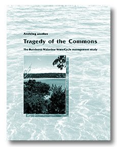
This problem was discussed in detail in the recently published PHPS Document Avoiding Another Tragedy of the Commons: The Bundeena Maianbar WaterCycle Management Study, which is available from PHPS, PO Box 744, SUTHERLAND 2232: (02) 95233680 PHPS Members Price $5, Non-members Price $11 (include $3 for postage) |
 |
| top of page |
|