Sand Dunes |
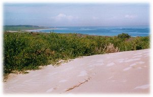
Photo: Daphne Salt |
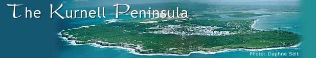
The Kurnell Peninsula was famous for its sandhills.
In terms of its geology and geomorphology, the Kurnell Peninsula is characterised by an island of outcropping bedrock on its eastern end (headland) joined to other bedrock outcrops on its western end by a sand spit which forms the main body of the Peninsula. Extensive sand dunes exist on the headland and rise 20-60m above sea level. The main body of the Peninsula is comprised of a number of overlapping transgressive barrier dunes which are understood to have migrated north from Bate Bay. Older stable parabolic dunes occur on a series of north-south oriented ridges and whilst much vegetation has been cleared, some dry schlerophyll woodland remains. |
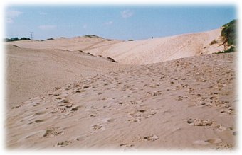
Photo: Daphne Salt |
Sandmining has removed a vast volume of sand. so that the previous mighty sandhills have almost all been carted away for building sand. Only a few dunes remain. These are located in areas such as Connell Hill (near Charlotte Breen Reserve), the Australand site, Botany Cone (in National Park), Calsil Dune and near Boat Harbour. Botany Cove is one of the largest coastal dunes remaining in Sydney.
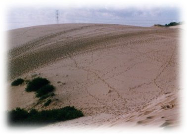
The dunes support a range of significant plant communities and species including the she-oak, red bloodwood, scribbly gum and smooth-barked apple. Calsil Dune (below) is one of the last remaining intact sand dunes on the Kurnell Peninsula. It rises 36m above the landscape and contains regionally significant native vegetation. This vegetation includes Kurnell Dune Forest which was, in 1999, listed as an Endangered Ecological Community under the NSW Threatened Species Conservation Act and is therefore of high conservation significance. |

Calsil Dune |
| Many community and conservation groups including the National Parks Association and Sutherland Shire Environment Centre have suggested that in order to ensure the long term preservation of Calsil Dune and its significant vegetation, it should be incorporated into Botany Bay National Park. Despite these suggestions, no reference to this management action has been included in the revised draft Plan of Management for the National Park (February 2000). |
Dune near Boat Harbour
Photo: Annette Hogan |
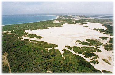
| Another significant dune is located on the Australand site. This dune rises about 50-60m above the landscape and would be at least half a kilometre wide. In its current unvegetated state, the dune is migrating in a north westerly direction under the influence of the predominant south easterly winds..In the late 1990s an application was made to the State Government to have the Australand dune Heritage-listed.. Proposals for residential development adjacent to the dune will have implications for the future of the dune in its current state and prominence. |
Australand Dune
Photo: Daphne Salt |
| The issue of dune stabilisation has also been the subject of some debate between community groups, Council and owners Australand. Heritage listing of the dune may also have a bearing on any stabilisation works. |

Australand Dune
Photo: Annette Hogan |
| top of page |