H1 Site |
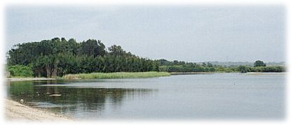 |
The H1 (Hookers 1) site is on the south-eastern shores of Woolooware Bay. The site is an abandoned sandmining pit which, since sandmining ceased on the site in the 1980s, has formed into a large deep lake.
The site is approximately 14 ha. At one stage the lake was a freshwater system but since a levee was breached in the mid to late 1990s, the lake had been influenced by the tides, and become saline. The land is currently owned by NSW Department of Infrastructure, Planning and Natural Resources, but the future of the site has been uncertain for a number of years. The sandmining company had undertaken some rehabilitation of the site, but many environment groups consider this to be inadequate and not complying with the company's consent. |
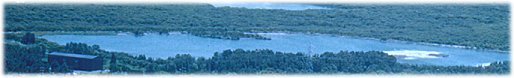
Photo: Daphne Salt |
As part of the new Draft Plan of Management for Towra Point Nature Reserve, National Parks and Wildlife Service pointed to the creation of an environmental education centre and "Gateway to the Peninsula" Centre as a possible future use of the site.
However, in April 2000, the NSW Roads and Traffic Authority identified the H1 area as a possible site for creation of compensatory habitat for wetlands in Rockdale which were compromised by the construction of the M5 East motorway. Replacement of wader bird habitat was a condition placed on Motorway construction by the State Government. Under the RTA plan, approximately 2 hectares of wader habitat was created along the shores of the lake. |
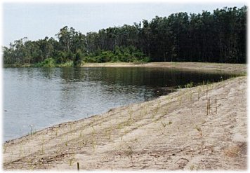 |
| The creation of wader habitat involved some clearing of vegetation, infilling of the lake's shoreline and replanting of vegetation (above). Vegetation was also cleared from the two islands in the middle of the lake. |
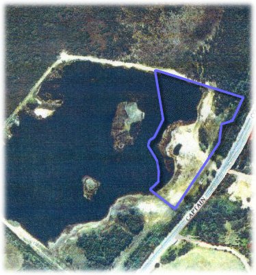
Aerial view of the H1 site. The area outlined in blue represents the extent of wader habitat created by the RTA project. |
A new weir will allow better tidal flushing from Woolooware Bay.
Any transfer of ownership to National Parks and Wildlife Service as an annex to Towra Point Nature Reserve would depend in part on whether the area becomes a functioning habitat for migratory birds. The RTA will monitor and maintain the site until about 2003/04. Early signs for the functionality of the site are positive with waders having recently moved onto the site to nest. |
| top of page |