Industry Intrudes |
Alterations to Botany Bay
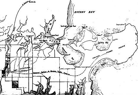
The year that Birnie obtained his Kurnell grant, 1815, Simeon Lord built a textile mill, followed ten years later by a flour mill, on the Lachlan Stream (now known as the Mill Ponds), on the northern side of Botany Bay adjacent to the now airport. There were three other wool-scouring mills on the northern side of Botany Bay by 1885. The Sydney City Sewage Farm was built in 1890 at the entrance to Cooks River, almost next door to the Lachlan Swamps at Botany (the Lachlan Swamps supplied Sydney with water for sixty years). Public pressure arising again from the threat of diseases such as the bubonic plague prompted the formation of the Sydney Harbour Trust in 1901 to control all of Sydney's waterways. Sixty years later it became the Maritime Services Board. The sewage farm closed in 1916.
The Banksmeadow Long Pier, also on the northern side of Botany Bay, was built for colliers from the Hunter River in 1880. In 1921 the Commonwealth Government acquired 64.5 hectares of land beside Cooks River for the development of an airport, though it was not until after the Second World War that major airport work began. |
 |
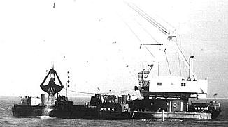
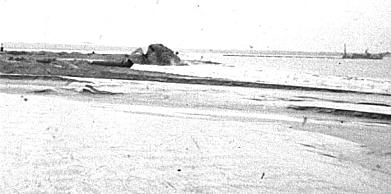
| The shoreline of Botany Bay has been increased by nearly 20 per cent by adding extra runway and port structures to the original shoreline, but the resultant impact on the ecosystem has been devastating. Dredging the bay has significantly altered wave direction, causing ongoing severe erosion along the western (Brighton) shore of the Bay and along the southern shore of Kurnell Peninsula. Protective groynes were built to absorb the altered, and now more powerful, wave energy impacting on Lady Robinsons Beach to the west and Kurnell's Silver Beach to the south. They have reduced but not stopped the erosion, and more than 50 per cent of the natural Botany Bay shoreline has had to be reconstructed. |
 |
| The shoreline of Botany Bay has been increased by nearly 20 per cent by adding extra runway and port structures to the original shoreline, but the resultant impact on the ecosystem has been devastating. Dredging the bay has significantly altered wave direction, causing ongoing severe erosion along the western (Brighton) shore of the Bay and along the southern shore of Kurnell Peninsula. Protective groynes were built to absorb the altered, and now more powerful, wave energy impacting on Lady Robinsons Beach to the west and Kurnell's Silver Beach to the south. They have reduced but not stopped the erosion, and more than 50 per cent of the natural Botany Bay shoreline has had to be reconstructed. |
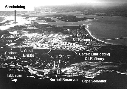 |
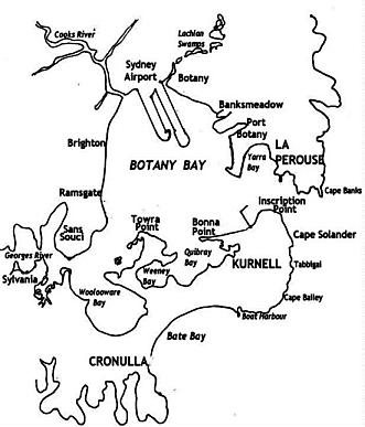
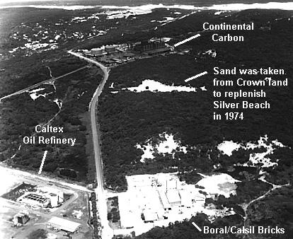
| Kurnell could very rightly be called the Black and White Peninsula, the white for its sandmining and its sand-made Calsil bricks, the black for its oil refineries and carbon black plants |
 |
| Industry has imposed a heavy footprint on the once pristine landscape of Kurnell. One century after it was designated for noxious trades and waste, the Kurnell Peninsula has largely become an industrial wilderness |
| top of page |