Barrier Swamp |
| |
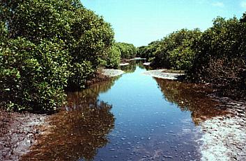
The area of mangroves towards the middle of Towra Point can be considered almost as a "Barrier Swamp" . The elevated causeway, which meanders through the saltmarsh ends at the Radar Station . A track continues for a distance across the saltmarsh communities, and then into the mangrove " Barrier Swamp" pictured above which is usually inundated with between 10 and 60cm of water depending on the tide.
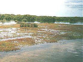
When you emerge from the mangroves (above) you encounter another extensive area of saltmarsh. The saltmarsh is seen here at high tide with the "Barrier Swamp" in the background. A short distance further along, the track then enters the terrestrial forest. |
 |
| Top of Page |