SSEC logo Towra Point Nature Reserve  
Towra Point home | about Towra | conservation | virtual tour | news | references  
• guided tour
• barrier swamp
• carters island
• entrance
• quibray bay
• radar station
• interpretive signs
• spit island
• towra beach
• towra lagoon
• vehicle
• weedy pond

Radar Station

Picture Picture

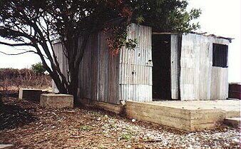
An old, dilapidated radar station was constructed in the late 1940s or early 1950s at the end of a raised causeway which today is the main access road to the Reserve. It was used by the Department of Civil Aviation. In the preceeding years oyster farmers have erected a shed on the foundations of the station.

Top of Page