Guided Tour of Towra Point |
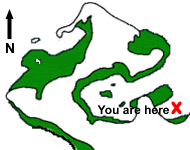
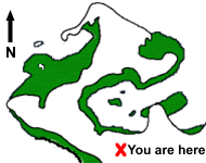
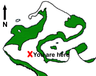
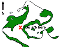
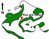
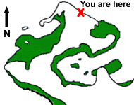
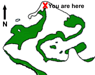
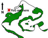
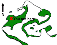
Welcome to the guided tour of Towra Point. You can see the tour route on the map below.
The images may take a few moments to load |

|
Stop 1 - Quibray Bay |
|
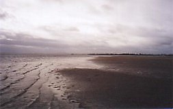
We start our tour at Quibray Bay. Adjacent to Quibray Bay is one of a few parcels of the Reserve which exist on the mainland of the Kurnell Peninsula. Here we can see extensive areas of mudflats/sandflats which are frequented by wading birds. The dune forest, which fringes the mudflats, is affected by invasive weeds such as bitou bush, pampas grass and lantana. Quibray Bay has been a major bush regeneration site and a lot of in-roads have been made into the weed problems in this area. |
 |
Stop 2 - Entrance |
|
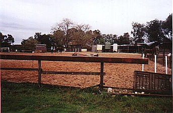
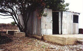
At stop 2 we approach the entrance to the main section of the Nature Reserve on Towra Peninsula itself. The horse stables pictured are also located near the entrance to the Reserve just off Captain Cook Drive. This poses problems in trying to prevent horses, who disturb birds and spread weeds, from accessing the Reserve.
We now have a 15 minute walk along the raised causeway to the next stop. This causeway was built to provide an access road for a radar station. Today the causeway is also a narrow corridor of terrestrial vegetation raised above the saltmarsh communities on each side. In 1998, efforts were undertaken to remove weeds such as lantana and bitou bush from the causeway and replant native species. |
 |
Stop 3 - End of the Causeway |
|
| Well we've reached the end of the raised causeway and here we notice three interesting features. One is the foundations of a radar station that was constructed in the late 1940s or early 1950s. At that time it was used by the Department of Civil Aviation. |
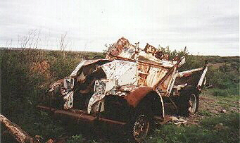 |
The second item is an abandoned vehicle located next to the radar station. Chances are this vehicle would have been used as transport when the station was in use for Sydney Airport. Recently, investigations have been undertaken to determine the heritage value of the vehicle and radar station. |
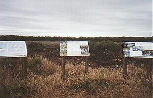 |
| Also at the end of the causeway are some interpretive signs. These signs, which overlook the saltmarsh, provide information about Towra Point and about wetlands in general. The signs were officially unveiled at a ceremony in December 1997 by the then Federal Member for Cook, Stephen Mutch. |
 |
As you can see the track ahead is no longer raised above the areas affected by the tides so we now need to take our shoes off or put some gum boots on. The track snakes across the salt marsh and eventually leads us into the "Barrier Swamp"
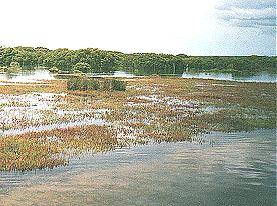
Stop 4 - Mangroves and Saltmarsh - "Barrier Swamp" |
|
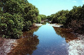
We continue along the track across the saltmarsh communities, and then we enter the mangrove " Barrier Swamp" pictured above. This area of mangroves is located towards the middle of Towra Point. You might have to roll up your trousers because the "Swamp" is usually covered with between 10 and 60cm of water even at low tide. On each side we can see hundreds of upright roots. |
 |
Stop 5 - Beyond the "Barrier Swamp" |
|
When we emerge from the mangroves we encounter another extensive area of saltmarsh. The saltmarsh is seen here at high tide and when we look back in the distance, we can see the "Barrier Swamp". A short distance further along, the track then enters the terrestrial forest where we can put our shoes back on!
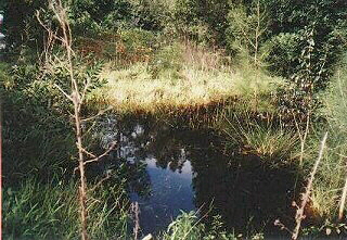
Stop 6 - Weedy Pond |
|
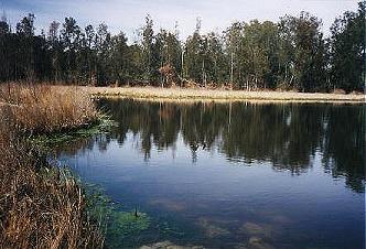
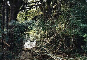
| About ten minutes after entering the terrestrial forest we come across Weedy Pond which is a small attractive freshwater wetland. If we have a look at the area surrounding the wetland we can see a pocket of littoral rainforest (below) which is rare in the Sydney region. Weedy Pond is also the site of major bush regeneration efforts and you can find out more in the Conservation section. |
 |
| The track continues along through the terrestrial forest pictured below which is characterised by species such as Bangalay and Acacia. The vegetation also forms storeys with the lower cover consisting of Bracken ferns and others. Unfortunately, lantana also forms part of the understorey in some areas |
 |
Stop 7 - Towra Beach |
|
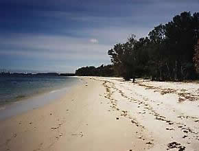
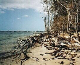
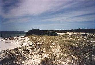
| After our 25 minute walk along the track through the terrestrial forest we then begin to catch a glipse of water. Yes we've reached Towra Beach which forms part of the southern shore of Botany Bay. We've actually emerged on the south-eastern section of Towra Beach (above) which despite suffering from erosion during storms, is relatively stable. You can see that there are no dead or dying banksia in this area. |
 |
But as we walk further west along the beach towards Towra Lagoon, we can see some very clear evidence of the erosion problems that exist along stretches of the beach. Prior to about 1950, the beach once extended approximately 20-30m further into the Bay in this area. The erosion appears to be concentrated on this north-western end which just happens to be the location of a once freshwater lagoon. Stop 8 - Towra Lagoon |
|
About 5 metres inland from the beach seen above is Towra Lagoon. This lagoon is an item of great cultural heritage value as it was mapped by Captain Cook when he was in Botany Bay in 1770. It once supported numerous fauna species including tortoises but due to the beach erosion and the subsequent saltwater inundation of the once freshwater lagoon, these species have all but disappeared.
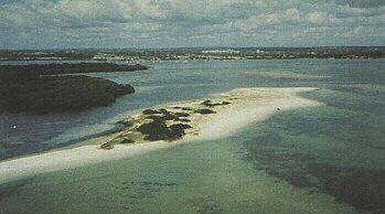
Stop 9 - Spit Island |
|
| Our second last, and one of our most significant stops on this tour is Spit Island. Spit Island has been managed as a breeding site for the endangered Little Tern since 1992. It is a favoured site by the Terns as it is isolated from the mainland of Towra Point and is therefore safe from predators such as foxes. As a result of NPWS management of this Island, Towra is now the second most important Little Tern breeding site on the NSW coast. |
 |
Stop 10 - Carters Island |
|
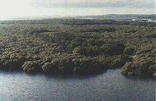
Our final stop for this Guided Tour is Carters Island. Carters Island consists of two small areas of terrestrial vegetation surrounded by mangroves which are the most highly developed mangrove stands at Towra. The mangroves provide an excellent roosting site for all sorts of birds and the mudflats that surround the island are frequented by wading birds.
Well that concludes our Guided Tour. In the near future we will hopefully be adding some extra sites so if you keep coming back...
Chances are the Tour will be different! |
| top of page |